Area Overview for KT17 1DE
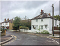
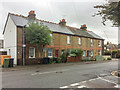
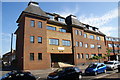
Photos of KT17 1DE


Area Information
KT17 1DE is a small, tightly knit residential postcode in England, home to 1,759 people. Its compact size means it feels more like a quiet village than a sprawling suburb, with a sense of community that is rare in larger urban areas. The area is defined by its proximity to key transport links and local amenities, making it accessible yet secluded. Daily life here is characterised by a balance between convenience and tranquillity — residents can reach rail stations, ferry landings, and retail hubs within minutes, yet the area itself retains a low-key charm. The demographic profile suggests a mature population, with a median age of 47 and most residents falling within the 30-64 age range. This hints at a stable, established community, likely centred around family life and long-term residency. While the area lacks major landmarks, its practicality and safety profile make it an attractive option for those seeking a manageable, well-connected home without the noise of a city.
- Area Type
- Postcode
- Area Size
- Not available
- Population
- 1759
- Population Density
- 4855 people/km²
KT17 1DE is a predominantly owner-occupied area, with 59% of residents owning their homes. The housing stock is composed largely of houses, which is unusual for smaller postcode areas that often feature flats or terraced properties. This suggests a mix of semi-detached and detached homes, catering to families and individuals seeking private, spacious living. The relatively high home ownership rate indicates a stable market, with fewer rental properties available. For buyers, this means competition may be limited, but the small size of the area means the surrounding regions are likely to offer more options. The presence of houses also implies a focus on long-term residency, with properties potentially holding value over time. However, the limited data on property prices or recent sales means buyers should consider nearby areas for a broader market picture.
House Prices in KT17 1DE
No properties found in this postcode.
Energy Efficiency in KT17 1DE
Living in KT17 1DE offers access to a range of practical amenities. The area is served by five retail outlets, including Co-op Epsom and Sainsburys Kiln, ensuring daily shopping needs are met. For transport, five rail stations and four ferry landings provide flexibility, with nearby metro stops like Belgrave Walk Tram Stop adding to the connectivity. While the data does not specify parks or leisure facilities, the presence of multiple transport hubs and retail options suggests a lifestyle that balances convenience with accessibility. The area’s small size means amenities are within walking or short driving distance, fostering a sense of ease in daily routines. The mix of retail, transport, and ferry access indicates a community designed for practicality, though further details on recreational spaces would be needed to fully assess leisure opportunities.
Amenities
Schools
The nearest school to KT17 1DE is Lintons Lane Centre, categorised as an 'other' type. While no Ofsted rating is provided, the presence of this facility suggests the area is served by educational institutions, though the specific focus or age range of the school is not detailed. The lack of additional schools in the data means families may need to look beyond the immediate postcode for primary or secondary options. This could be a consideration for buyers prioritising proximity to schools, as the current offering is limited. However, the area’s transport links, including nearby rail stations, may provide access to broader educational networks in adjacent towns.
| Rank | School | Type | Entry gender | Ages |
|---|
Explore more schools in this area
Go to Schools tabDemographics
The population of KT17 1DE is predominantly adults aged 30-64, with a median age of 47. This suggests a mature, settled community, likely with a high proportion of homeowners. Home ownership stands at 59%, indicating that nearly six in ten residents own their homes, which is slightly above the national average for similar areas. The accommodation type is primarily houses, which aligns with the demographic profile of a family-oriented population. The predominant ethnic group is White, reflecting a homogenous community. While no specific data on deprivation is provided, the high home ownership rate and stable age distribution imply a relatively stable economic environment. This could translate to lower pressure on local services and a more predictable cost of living. The absence of detailed diversity metrics means the area’s social fabric is not extensively documented, but the figures suggest a cohesive, long-established population.
Household Size
Accommodation Type
Tenure
Ethnic Group
Religion
Household Composition
Age
Household Deprivation
NS-SEC
Explore more demographic insights in this area
Go to Demographics tabPlanning
Planning Constraints
- Flood RiskPremium
- Ramsar Wetland SitesPremium
- Area of Outstanding Natural BeautyPremium
- Protected Nature ReservePremium
- Protected WoodlandPremium