Area Overview for KT17 1DB
Photos of KT17 1DB
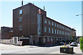
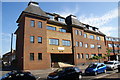
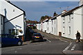
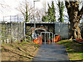
33 photos from this area
Area Information
Key information about the KT17 1DB including its size, population, and administrative classification.
- Area Type
- Postcode
- Area Size
- 1646 m²
- Population
- 1759
- Population Density
- 4855 people/km²
House Prices in KT17 1DB
8
Properties
£337,256
Average Sold Price
£199,950
Lowest Price
£545,000
Highest Price
Showing 8 properties
| Address | Type | Beds | Baths | Last Sale Price | Last Sale Date | |
|---|---|---|---|---|---|---|
| 17 Lintons Lane, Epsom, KT17 1DB | Semi-detached | 2 | 1 | £401,000 | Mar 2023 | |
| 9 Lintons Lane, Epsom, KT17 1DB | Semi-detached | 2 | 1 | £384,000 | Mar 2021 | |
| 11-13 Lintons Lane, Epsom, KT17 1DB | Detached | 2 | 2 | £545,000 | Mar 2021 | |
| 1 Lintons Lane, Epsom, KT17 1DB | Semi-detached | 2 | - | £355,600 | Aug 2020 | |
| 3 Lintons Lane, Epsom, KT17 1DB | Semi-detached | 2 | 1 | £330,000 | Feb 2019 | |
| 5 Lintons Lane, Epsom, KT17 1DB | Detached | 2 | 1 | £199,950 | Feb 2007 | |
| 15 Lintons Lane, Epsom, KT17 1DB | Semi-detached | - | - | £233,500 | Apr 2006 | |
| 7 Lintons Lane, Epsom, KT17 1DB | Semi-detached | - | - | £249,000 | Oct 2004 |
Energy Efficiency in KT17 1DB
Amenities
Schools
| Rank | School | Type | Entry gender | Ages |
|---|
Explore more schools in this area
Go to Schools tabDemographics
Household Size
Family (3-5 people)
most common
Accommodation Type
Houses
most common
Tenure
59
majority
Ethnic Group
White
most common
Religion
N/A
most common
Household Composition
N/A
most common
Age
47
median
Adults (30-64 years)
most common
Household Deprivation
N/A
with no deprivation
NS-SEC
47
in Lower managerial occupations
Explore more demographic insights in this area
Go to Demographics tabPlanning
Planning Constraints
- Flood RiskPremium
- Ramsar Wetland SitesPremium
- Area of Outstanding Natural BeautyPremium
- Protected Nature ReservePremium
- Protected WoodlandPremium