Area Overview for KT16 9TT
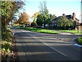
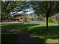
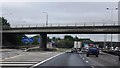
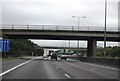
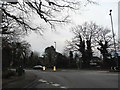
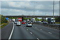
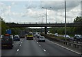
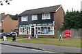
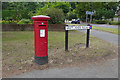
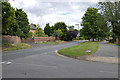
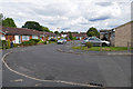
Photos of KT16 9TT

Area Information
KT16 9TT is a small residential postcode area in England, home to 1,861 residents spread across a compact cluster. With a population density of 1,618 people per square kilometre, it reflects a tightly knit community where proximity to amenities and services is a defining feature. The area’s character is shaped by its mix of housing stock, predominantly owner-occupied homes, and its accessibility to nearby towns and transport links. Daily life here balances suburban tranquillity with practical connectivity, offering residents a blend of local shops, schools, and transport options within reach. The median age of 47 suggests a mature demographic, with adults aged 30–64 forming the largest group. This reflects a stable, established community where families and long-term residents coexist. Living in KT16 9TT means navigating a small, manageable area where most needs are met locally, though its size also means the surrounding regions play a significant role in broader lifestyle choices. The area’s compact nature ensures that residents are never far from key services, whether for commuting, shopping, or leisure.
- Area Type
- Postcode
- Area Size
- Not available
- Population
- 1861
- Population Density
- 1618 people/km²
KT16 9TT is primarily an owner-occupied area, with 76% of properties owned by residents rather than rented. This suggests a stable housing market where long-term investment is common. The accommodation type is predominantly houses, which is typical for areas with lower population density and a mature demographic. This housing stock may appeal to families or individuals seeking more space than a flat could offer. However, the small size of the postcode area means the property market is limited in scope, with buyers needing to consider nearby regions for broader options. The high home ownership rate indicates a lower rental market presence, which could affect availability for renters. For buyers, this means a focus on existing homes rather than new developments, with potential for property appreciation in a low-turnover environment. The compact nature of the area also means that proximity to transport and amenities is a key selling point, as residents rely on nearby towns for additional services.
House Prices in KT16 9TT
No properties found in this postcode.
Energy Efficiency in KT16 9TT
Living in KT16 9TT offers access to a range of amenities that support both practical needs and leisure. Local retail options include Co-op Addlestone, Tesco Chertsey, and The Southern Co-operative Co, ensuring residents can shop for essentials without long journeys. The presence of ferry landings at Shepperton and Weybridge adds a unique dimension, offering water-based transport and recreational opportunities. Fairoaks Airport, though not a major hub, provides direct air travel for those requiring regional or international connections. While the data does not specify parks or leisure facilities, the area’s proximity to rail stations and retail hubs suggests a lifestyle focused on convenience and connectivity. The compact nature of KT16 9TT means that most amenities are within walking or short driving distance, supporting a low-stress, accessible daily routine. For those valuing ease of movement and proximity to services, this area offers a practical balance between suburban comfort and urban accessibility.
Amenities
Schools
Residents of KT16 9TT have access to several schools within practical reach. Meadowcroft Community Primary School, a primary school with an Ofsted rating of ‘good’, serves the area’s younger population. Salesian School in Chertsey is listed twice in the data: once as a primary school and once as an academy with an ‘outstanding’ Ofsted rating. This duplication may reflect the school’s dual designation or a data entry error, but it highlights the availability of high-quality education options. The presence of both a primary school and an outstanding academy provides families with choices, whether for younger children or secondary education. The mix of school types ensures that residents can access either state-run or academy-led institutions, depending on their needs. For families prioritising education, the proximity of these schools reduces commuting time and supports a balanced lifestyle. The ‘outstanding’ rating at Salesian School, in particular, underscores the area’s appeal for those seeking top-tier schooling.
| Rank | School | Type | Entry gender | Ages |
|---|
Explore more schools in this area
Go to Schools tabDemographics
The population of KT16 9TT is predominantly adults aged 30–64, with a median age of 47. This suggests a mature, established community where many residents have lived for years, contributing to a sense of continuity. Home ownership is high, with 76% of households owning their homes, indicating a stable property market and long-term residency. The area is characterised by houses rather than flats, which aligns with the demographic profile of older, family-oriented residents. The predominant ethnic group is White, though no specific data on diversity or deprivation is provided. The absence of detailed diversity statistics means the area’s cultural composition remains less defined in the data. For quality of life, the high home ownership rate and stable age profile suggest a low turnover of residents, fostering a familiar, community-focused environment. However, without additional data on income levels or deprivation, it is unclear how economic factors might influence daily living here.
Household Size
Accommodation Type
Tenure
Ethnic Group
Religion
Household Composition
Age
Household Deprivation
NS-SEC
Explore more demographic insights in this area
Go to Demographics tabPlanning
Planning Constraints
- Flood RiskPremium
- Ramsar Wetland SitesPremium
- Area of Outstanding Natural BeautyPremium
- Protected Nature ReservePremium
- Protected WoodlandPremium