Area Overview for KT16 9RT
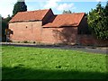
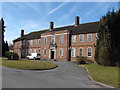
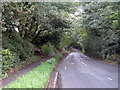
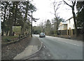
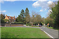
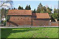
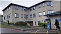
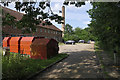
Photos of KT16 9RT
Area Information
KT16 9RT is a small residential postcode area in England, covering 1,642 square metres and home to 1,474 residents. With a population density of 183 people per square kilometre, this area reflects a compact, closely knit community. The median age of 47 suggests a mature demographic, with the majority of residents falling between 30 and 64 years old. Living here means navigating a mix of practical amenities and a quieter suburban environment. The area’s proximity to Chertsey Railway Station and nearby retail hubs like Tesco Chertsey and Aldi Chertsey ensures daily essentials are within reach. While the postcode lacks large-scale infrastructure, its small size fosters a sense of familiarity. Residents benefit from nearby natural features, though no protected landscapes or wetlands are present. For those prioritising convenience over expansive green spaces, KT16 9RT offers a straightforward lifestyle with minimal planning constraints. However, the area’s safety profile requires attention, as crime rates are above average. This postcode is ideal for buyers seeking a manageable, low-maintenance home in a defined, localised setting.
- Area Type
- Postcode
- Area Size
- 1642 m²
- Population
- 1474
- Population Density
- 183 people/km²
KT16 9RT is characterised by a home ownership rate of 63%, indicating that the majority of properties are owner-occupied rather than rented. The accommodation type is predominantly houses, which is typical of smaller, suburban postcode areas. This suggests a housing stock that is largely composed of individual homes rather than flats or apartments, which may appeal to buyers seeking family-friendly or long-term living options. Given the area’s small size and limited population, the property market is likely to be niche, with fewer options available compared to larger urban centres. The concentration of houses may also mean that properties are more spread out, requiring consideration of commuting distances. For buyers, this implies a focus on individual homes in a low-density setting, with potential for stable value retention due to the area’s limited development pressures. However, the small size of KT16 9RT means the market is not expansive, and competition for available properties could be keen.
House Prices in KT16 9RT
No properties found in this postcode.
Energy Efficiency in KT16 9RT
KT16 9RT offers a range of amenities within practical reach, enhancing daily life for residents. The nearby rail stations—Chertsey, Addlestone, and Virginia Water—facilitate easy access to commuting routes and regional connections. Retail options include Tesco Chertsey, Aldi Chertsey, and The Southern Co-operative Co, ensuring grocery and household needs are met locally. Fairoaks Airport provides regional air travel access, while Shepperton and Weybridge Ferry Landings offer alternative transport methods along the river. Though the area lacks large-scale leisure facilities, the proximity to rail and ferry services supports both local and broader mobility. The presence of White Lodge Children’s Centre adds to the community’s practical offerings, catering to early years care. While the area’s amenities are modest, they reflect a focus on convenience and accessibility, allowing residents to manage daily routines without long commutes. The mix of retail, transport, and basic services creates a functional, if unpretentious, lifestyle in KT16 9RT.
Amenities
Schools
Near KT16 9RT, Lyne and Longcross CofE Aided Primary School serves the area with a good Ofsted rating, providing a solid foundation for young children’s education. Additionally, White Lodge Children’s Centre offers early years support, though it is not a formal school. The presence of a primary school with a positive rating is a key consideration for families with young children, as it ensures access to quality education within the local area. However, the absence of secondary schools or further education institutions means parents may need to look beyond KT16 9RT for comprehensive schooling. The mix of educational facilities suggests a focus on early childhood development but highlights a gap in secondary education options. For families prioritising proximity to schools, the primary school’s good rating is a strong point, but the lack of secondary schooling may require careful planning for older children’s education.
| Rank | School | Type | Entry gender | Ages |
|---|
Explore more schools in this area
Go to Schools tabDemographics
The population of KT16 9RT is predominantly adults aged 30 to 64, with a median age of 47. Home ownership stands at 63%, indicating a stable community where most residents live in their own homes. The accommodation type is primarily houses, reflecting a residential area with limited high-density housing. The predominant ethnic group is White, with no specific data on other demographics provided. The population density of 183 people per square kilometre suggests a low-pressure living environment, though it does not indicate levels of deprivation or socioeconomic diversity. This demographic profile implies a community with established households and a focus on long-term residency. The absence of detailed diversity statistics means the area’s cultural composition remains opaque, but the data confirms a relatively uniform age and ownership structure. For buyers, this suggests a market skewed towards owner-occupiers with a preference for single-family homes.
Household Size
Accommodation Type
Tenure
Ethnic Group
Religion
Household Composition
Age
Household Deprivation
NS-SEC
Explore more demographic insights in this area
Go to Demographics tabPlanning
Planning Constraints
- Flood RiskPremium
- Ramsar Wetland SitesPremium
- Area of Outstanding Natural BeautyPremium
- Protected Nature ReservePremium
- Protected WoodlandPremium