Area Overview for KT16 9LD
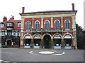
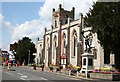
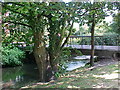
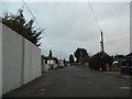
Photos of KT16 9LD


Area Information
KT16 9LD is a small residential postcode in England with a population of 1894, encompassing a tightly knit cluster of homes. The area is characterised by a mature demographic, with a median age of 47 and a majority of residents aged 30–64. This suggests a community of established professionals and families, many of whom own their homes, with 67% of properties owner-occupied. The area’s compact size means it is not sprawling, but it is well-served by nearby amenities. Residents benefit from proximity to Chertsey’s retail hubs, including Aldi, Sainsburys, and Tesco, as well as multiple rail stations offering connections to London and beyond. The postcode’s location near Heathrow Airport and accessible ferry services adds to its appeal for commuters and those requiring frequent travel. While the area is not large, its mix of practical infrastructure and quiet residential character makes it a viable choice for those seeking a balanced lifestyle with easy access to urban and rural amenities.
- Area Type
- Postcode
- Area Size
- Not available
- Population
- 1894
- Population Density
- 3304 people/km²
KT16 9LD is a small area with a housing stock dominated by owner-occupied homes, with 67% of properties in private hands. The accommodation type is exclusively houses, which is unusual for areas with higher apartment or flat density. This suggests a market skewed towards family homes and those seeking more space, rather than rental properties or smaller units. The limited size of the postcode means the housing stock is not extensive, and buyers should consider the proximity to surrounding areas for additional options. The high home ownership rate indicates a stable market, but the small scale of the area may limit availability for those seeking immediate purchase. For buyers, the focus on houses could appeal to those prioritising privacy and space, though the lack of diverse property types may narrow choices.
House Prices in KT16 9LD
No properties found in this postcode.
Energy Efficiency in KT16 9LD
Living in KT16 9LD provides access to a range of amenities within practical reach. The area is served by five retail outlets, including Aldi Chertsey, Sainsburys Chertsey, and Tesco Chertsey, ensuring everyday shopping needs are met. Three rail stations—Chertsey, Addlestone, and Virginia Water—offer seamless links to London and nearby towns. For those preferring water transport, Shepperton and Weybridge ferry landings provide alternative routes. The proximity to Heathrow Airport and Fairoaks Airport, along with Heathrow Central Bus Station, adds to the area’s connectivity. While the postcode itself is small, its integration with surrounding infrastructure ensures residents have access to both local conveniences and major transport hubs. This balance of retail, transport, and travel options supports a lifestyle that combines residential comfort with urban accessibility.
Amenities
Schools
| Rank | School | Type | Entry gender | Ages |
|---|
Explore more schools in this area
Go to Schools tabDemographics
The community in KT16 9LD is predominantly composed of adults aged 30–64, with a median age of 47. This indicates a mature population, likely consisting of professionals and families who have settled in the area long-term. Home ownership is high, at 67%, suggesting a stable housing market with a focus on private residences rather than rentals. The accommodation type is primarily houses, reflecting a preference for single-family homes over flats or apartments. The predominant ethnic group is White, which aligns with broader regional trends. While no specific deprivation data is provided, the high home ownership rate and age profile suggest a community with established economic stability. The absence of detailed diversity metrics means the area’s demographic composition is not fully quantified, but the available data points to a cohesive, long-term resident base.
Household Size
Accommodation Type
Tenure
Ethnic Group
Religion
Household Composition
Age
Household Deprivation
NS-SEC
Explore more demographic insights in this area
Go to Demographics tabPlanning
Planning Constraints
- Flood RiskPremium
- Ramsar Wetland SitesPremium
- Area of Outstanding Natural BeautyPremium
- Protected Nature ReservePremium
- Protected WoodlandPremium