Area Overview for KT16 9EZ
Photos of KT16 9EZ
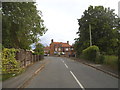
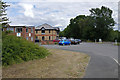
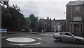
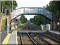
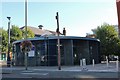
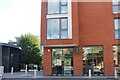
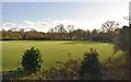
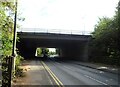
56 photos from this area
Area Information
Key information about the KT16 9EZ including its size, population, and administrative classification.
- Area Type
- Postcode
- Area Size
- 1.6 hectares
- Population
- 1535
- Population Density
- 3645 people/km²
House Prices in KT16 9EZ
39
Properties
£288,500
Average Sold Price
£68,000
Lowest Price
£438,500
Highest Price
Showing 39 properties
| Address | Type | Beds | Baths | Last Sale Price | Last Sale Date | |
|---|---|---|---|---|---|---|
| 4 Frithwald Road, Chertsey, KT16 9EZ | Semi-detached | 2 | - | £432,000 | Jul 2025 | |
| 26 Frithwald Road, Chertsey, KT16 9EZ | Terraced | 3 | 1 | £415,000 | Jan 2025 | |
| 14 Frithwald Road, Chertsey, KT16 9EZ | Semi-detached | 3 | - | £400,000 | Aug 2024 | |
| 24 Frithwald Road, Chertsey, KT16 9EZ | Terraced | 3 | 1 | £438,500 | Jun 2023 | |
| 39 Frithwald Road, Chertsey, KT16 9EZ | Semi-detached | 4 | 4 | £430,500 | Jan 2022 | |
| 12 Frithwald Road, Chertsey, KT16 9EZ | Semi-detached | 3 | - | £405,000 | Dec 2016 | |
| 30 Frithwald Road, Chertsey, KT16 9EZ | Terraced | 3 | - | £249,000 | Jun 2013 | |
| 35 Frithwald Road, Chertsey, KT16 9EZ | Terraced | 3 | 2 | £235,000 | Jun 2008 | |
| 38 Frithwald Road, Chertsey, KT16 9EZ | Semi-detached | 3 | - | £225,000 | Jan 2008 | |
| 2 Frithwald Road, Chertsey, KT16 9EZ | Semi-detached | - | - | £84,000 | Nov 1997 |
Page 1 of 4
Energy Efficiency in KT16 9EZ
Amenities
Schools
| Rank | School | Type | Entry gender | Ages |
|---|
Explore more schools in this area
Go to Schools tabDemographics
Household Size
Family (3-5 people)
most common
Accommodation Type
Houses
most common
Tenure
36
majority
Ethnic Group
White
most common
Religion
N/A
most common
Household Composition
N/A
most common
Age
47
median
Adults (30-64 years)
most common
Household Deprivation
N/A
with no deprivation
NS-SEC
29
in Lower managerial occupations
Explore more demographic insights in this area
Go to Demographics tabPlanning
Planning Constraints
- Flood RiskPremium
- Ramsar Wetland SitesPremium
- Area of Outstanding Natural BeautyPremium
- Protected Nature ReservePremium
- Protected WoodlandPremium