Area Overview for KT16 8RR
Photos of KT16 8RR


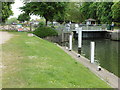
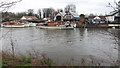
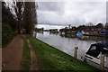
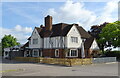
66 photos from this area
Area Information
Key information about the KT16 8RR including its size, population, and administrative classification.
- Area Type
- Postcode
- Area Size
- 4.3 hectares
- Population
- 1433
- Population Density
- 605 people/km²
House Prices in KT16 8RR
28
Properties
£561,406
Average Sold Price
£110,000
Lowest Price
£975,000
Highest Price
Showing 28 properties
| Address | Type | Beds | Baths | Last Sale Price | Last Sale Date | |
|---|---|---|---|---|---|---|
| Coombe Bank, 26 Laleham Reach, Chertsey, KT16 8RR | Bungalow | 4 | 2 | £650,000 | Aug 2025 | |
| Avoca, 44 Laleham Reach, Chertsey, KT16 8RR | Detached | 4 | 1 | £540,000 | Aug 2025 | |
| Casino, 43 Laleham Reach, Chertsey, KT16 8RR | Detached | 3 | 1 | £975,000 | Mar 2025 | |
| Avalon, 29 Laleham Reach, Chertsey, KT16 8RR | Bungalow | 2 | 1 | £655,000 | Dec 2024 | |
| Willowside, 40 Laleham Reach, Chertsey, KT16 8RR | Detached | 4 | 2 | £800,000 | Sep 2020 | |
| The Stoep, 38 Laleham Reach, Chertsey, KT16 8RR | house | 2 | 2 | £427,500 | Jun 2017 | |
| Parisiana, 47 Laleham Reach, Chertsey, KT16 8RR | house | - | - | £750,000 | Dec 2016 | |
| Yolo, 48 Laleham Reach, Chertsey, KT16 8RR | Detached | 3 | 1 | £400,000 | Jan 2016 | |
| Walnut Tree Cottage, 30 Laleham Reach, Chertsey, KT16 8RR | Bungalow | 3 | - | £565,000 | Oct 2013 | |
| Tudor Rose, 25 Laleham Reach, Chertsey, KT16 8RR | Bungalow | 3 | - | £460,000 | May 2012 |
Page 1 of 3
Energy Efficiency in KT16 8RR
Amenities
Schools
| Rank | School | Type | Entry gender | Ages |
|---|
Explore more schools in this area
Go to Schools tabDemographics
Household Size
One person
most common
Accommodation Type
Other
most common
Tenure
79
majority
Ethnic Group
White
most common
Religion
N/A
most common
Household Composition
N/A
most common
Age
47
median
Adults (30-64 years)
most common
Household Deprivation
N/A
with no deprivation
NS-SEC
33
in Lower managerial occupations
Explore more demographic insights in this area
Go to Demographics tabPlanning
Planning Constraints
- Flood RiskPremium
- Ramsar Wetland SitesPremium
- Area of Outstanding Natural BeautyPremium
- Protected Nature ReservePremium
- Protected WoodlandPremium