Area Overview for KT16 8NR
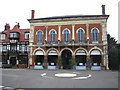
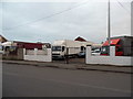
Photos of KT16 8NR


Area Information
Living in KT16 8NR offers a compact, residential experience with a population of 1,495 spread across a densely populated area, at 1,397 people per square kilometre. This postcode covers a small cluster of homes, predominantly houses, reflecting a stable community with a median age of 47. The area is characterised by its proximity to key transport links, including multiple railway stations and ferry landings, making it accessible for commuters. Residents benefit from a low crime risk, with a safety score of 81, and no significant environmental hazards such as flood zones or protected natural areas. Daily life here is shaped by nearby amenities like supermarkets, rail services, and proximity to Heathrow Airport. While the area is small, its connectivity to surrounding towns and major infrastructure ensures a balance between residential tranquillity and practical convenience. For those seeking a compact, well-connected neighbourhood with a mature demographic, KT16 8NR provides a straightforward, no-frills living environment.
- Area Type
- Postcode
- Area Size
- Not available
- Population
- 1495
- Population Density
- 1397 people/km²
The property market in KT16 8NR is dominated by owner-occupied homes, with 70% of properties in private hands. This high home ownership rate suggests a community of long-term residents rather than a transient rental market. The accommodation type is predominantly houses, which are more common than flats or apartments in this area. This makes KT16 8NR a niche market for buyers seeking traditional family homes, though the small size of the postcode means the housing stock is limited. For those considering this area, the proximity to nearby towns and transport links may be a draw, but the immediate surroundings are likely to be the primary source of property options. The absence of rental properties indicates a focus on stability, but buyers should be aware that the market may not cater to those seeking short-term or flexible housing solutions.
House Prices in KT16 8NR
No properties found in this postcode.
Energy Efficiency in KT16 8NR
KT16 8NR’s lifestyle is defined by its proximity to essential amenities and transport hubs. Residents have access to five retail outlets, including The Southern Co-operative, Tesco Chertsey, and Sainsburys Chertsey, ensuring daily shopping needs are met locally. The area’s rail network, with stations at Chertsey, Addlestone, and Shepperton, links it to wider regional and London-based services. Ferry landings at Shepperton and Weybridge provide alternative travel routes, while Heathrow Airport and Heathrow Central Bus Station offer direct links to national and international destinations. Though the area itself is small, its integration with surrounding infrastructure means residents can enjoy a mix of convenience and connectivity. The presence of multiple transport options and retail services suggests a practical, accessible lifestyle, though the area’s compact nature may limit local leisure or entertainment options beyond what is strictly necessary.
Amenities
Schools
| Rank | School | Type | Entry gender | Ages |
|---|
Explore more schools in this area
Go to Schools tabDemographics
The community in KT16 8NR is predominantly composed of adults aged 30–64, with a median age of 47, indicating a mature population profile. Home ownership is high, at 70%, suggesting a stable, long-term resident base. The area is largely occupied by houses, reflecting a preference for traditional family homes over flats or apartments. The predominant ethnic group is White, with no specific data provided on other demographics. The population density of 1,397 people per square kilometre implies a tightly packed residential cluster, though the area’s small size means it is not a sprawling suburb. This demographic structure suggests a community focused on established households, possibly professionals or retirees, with limited diversity in age or cultural composition. The absence of specific data on deprivation or income levels means quality of life can only be inferred from the available metrics, such as safety and connectivity.
Household Size
Accommodation Type
Tenure
Ethnic Group
Religion
Household Composition
Age
Household Deprivation
NS-SEC
Explore more demographic insights in this area
Go to Demographics tabPlanning
Planning Constraints
- Flood RiskPremium
- Ramsar Wetland SitesPremium
- Area of Outstanding Natural BeautyPremium
- Protected Nature ReservePremium
- Protected WoodlandPremium