Area Overview for KT16 8JZ
Photos of KT16 8JZ
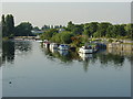

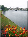
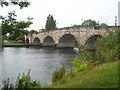
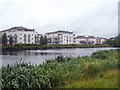
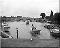
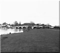
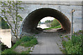
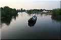
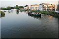
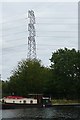
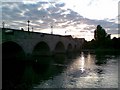
100 photos from this area
Area Information
Key information about the KT16 8JZ including its size, population, and administrative classification.
- Area Type
- Postcode
- Area Size
- 2.0 hectares
- Population
- 1433
- Population Density
- 605 people/km²
House Prices in KT16 8JZ
19
Properties
£1,274,874
Average Sold Price
£187,500
Lowest Price
£3,991,996
Highest Price
Showing 19 properties
| Address | Type | Beds | Baths | Last Sale Price | Last Sale Date | |
|---|---|---|---|---|---|---|
| 75 Bridge Road, Chertsey, KT16 8JZ | Semi-detached | 3 | 1 | £605,000 | Apr 2023 | |
| The Managers Flat, The Boathouse And Bridge Lodge, 79-81 Bridge Road, Chertsey, KT16 8JZ | Detached | 4 | - | £3,991,996 | Mar 2018 | |
| 69 Bridge Road, Chertsey, KT16 8JZ | Flat | 2 | 1 | £315,000 | Dec 2003 | |
| 71 Bridge Road, Chertsey, KT16 8JZ | Terraced | - | - | £187,500 | May 2000 | |
| 10, Belsize Grange, 77 Bridge Road, Chertsey, KT16 8JZ | Flat | 1 | 1 | - | - | |
| 7, Belsize Grange, 77 Bridge Road, Chertsey, KT16 8JZ | Flat | 1 | 1 | - | - | |
| 73 Bridge Road, Chertsey, KT16 8JZ | house | - | - | - | - | |
| 6, Belsize Grange, 77 Bridge Road, Chertsey, KT16 8JZ | Flat | 1 | 1 | - | - | |
| The Camping And Caravanning Club, Camping And Caravanning Ground, Bridge Road, Chertsey, KT16 8JZ | commercial | - | - | - | - | |
| 1, Belsize Grange, 77 Bridge Road, Chertsey, KT16 8JZ | Flat | 1 | - | - | - |
Page 1 of 2
Energy Efficiency in KT16 8JZ
Amenities
Schools
| Rank | School | Type | Entry gender | Ages |
|---|
Explore more schools in this area
Go to Schools tabDemographics
Household Size
One person
most common
Accommodation Type
Other
most common
Tenure
79
majority
Ethnic Group
White
most common
Religion
N/A
most common
Household Composition
N/A
most common
Age
47
median
Adults (30-64 years)
most common
Household Deprivation
N/A
with no deprivation
NS-SEC
33
in Lower managerial occupations
Explore more demographic insights in this area
Go to Demographics tabPlanning
Planning Constraints
- Flood RiskPremium
- Ramsar Wetland SitesPremium
- Area of Outstanding Natural BeautyPremium
- Protected Nature ReservePremium
- Protected WoodlandPremium