Area Overview for KT16 8HQ
Photos of KT16 8HQ
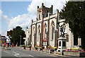
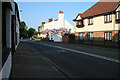
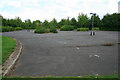
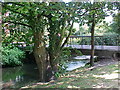
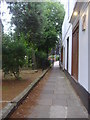
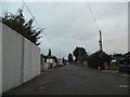
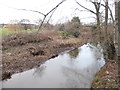
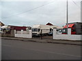
100 photos from this area
Area Information
Key information about the KT16 8HQ including its size, population, and administrative classification.
- Area Type
- Postcode
- Area Size
- 8105 m²
- Population
- 1898
- Population Density
- 4353 people/km²
House Prices in KT16 8HQ
17
Properties
£269,829
Average Sold Price
£95,000
Lowest Price
£405,000
Highest Price
Showing 17 properties
| Address | Type | Beds | Baths | Last Sale Price | Last Sale Date | |
|---|---|---|---|---|---|---|
| 104 Fordwater Road, Chertsey, KT16 8HQ | Bungalow | 2 | 1 | £350,000 | Oct 2025 | |
| 112 Fordwater Road, Chertsey, KT16 8HQ | Bungalow | 2 | 1 | £351,000 | Jan 2025 | |
| 106 Fordwater Road, Chertsey, KT16 8HQ | Bungalow | 2 | 1 | £345,000 | Jun 2022 | |
| 100 Fordwater Road, Chertsey, KT16 8HQ | Bungalow | - | - | £405,000 | Dec 2021 | |
| 98 Fordwater Road, Chertsey, KT16 8HQ | Bungalow | 2 | 1 | £365,000 | Jul 2020 | |
| 90 Fordwater Road, Chertsey, KT16 8HQ | Bungalow | 2 | 1 | £340,000 | May 2018 | |
| 94 Fordwater Road, Chertsey, KT16 8HQ | Semi-detached | 2 | 1 | £325,000 | Apr 2018 | |
| 110 Fordwater Road, Chertsey, KT16 8HQ | Bungalow | 2 | 1 | £229,950 | Nov 2013 | |
| 96 Fordwater Road, Chertsey, KT16 8HQ | Bungalow | 2 | 1 | £217,000 | Sep 2007 | |
| 116 Fordwater Road, Chertsey, KT16 8HQ | Terraced | - | - | £100,000 | Dec 2001 |
Page 1 of 2
Energy Efficiency in KT16 8HQ
Amenities
Schools
| Rank | School | Type | Entry gender | Ages |
|---|
Explore more schools in this area
Go to Schools tabDemographics
Household Size
Family (3-5 people)
most common
Accommodation Type
Houses
most common
Tenure
72
majority
Ethnic Group
White
most common
Religion
N/A
most common
Household Composition
N/A
most common
Age
47
median
Adults (30-64 years)
most common
Household Deprivation
N/A
with no deprivation
NS-SEC
39
in Lower managerial occupations
Explore more demographic insights in this area
Go to Demographics tabPlanning
Planning Constraints
- Flood RiskPremium
- Ramsar Wetland SitesPremium
- Area of Outstanding Natural BeautyPremium
- Protected Nature ReservePremium
- Protected WoodlandPremium