Area Overview for KT15 3NR
Photos of KT15 3NR
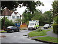
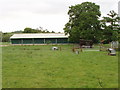
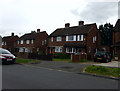
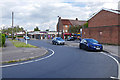
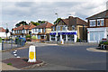
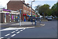
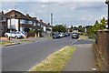
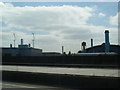
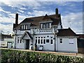

28 photos from this area
Area Information
Key information about the KT15 3NR including its size, population, and administrative classification.
- Area Type
- Postcode
- Area Size
- 8783 m²
- Population
- 1373
- Population Density
- 3254 people/km²
House Prices in KT15 3NR
23
Properties
£371,598
Average Sold Price
£115,000
Lowest Price
£550,000
Highest Price
Showing 23 properties
| Address | Type | Beds | Baths | Last Sale Price | Last Sale Date | |
|---|---|---|---|---|---|---|
| 211 Woodham Lane, Addlestone, KT15 3NR | Bungalow | - | - | £425,000 | Mar 2021 | |
| 201 Woodham Lane, Addlestone, KT15 3NR | Semi-detached | 3 | 1 | £515,000 | Jan 2021 | |
| 215 Woodham Lane, Addlestone, KT15 3NR | Bungalow | - | - | £425,000 | Dec 2020 | |
| 195 Woodham Lane, Addlestone, KT15 3NR | Bungalow | 4 | 2 | £550,000 | Sep 2019 | |
| 219 Woodham Lane, Addlestone, KT15 3NR | Bungalow | 3 | - | £297,320 | Sep 2019 | |
| 197 Woodham Lane, Addlestone, KT15 3NR | Semi-detached | 3 | 1 | £485,000 | May 2019 | |
| 199 Woodham Lane, Addlestone, KT15 3NR | Detached | 3 | 2 | £440,000 | Mar 2016 | |
| 217 Woodham Lane, Addlestone, KT15 3NR | Detached | 3 | - | £495,000 | Sep 2015 | |
| 221 Woodham Lane, Addlestone, KT15 3NR | Detached | 3 | 1 | £349,500 | Nov 2013 | |
| 193 Woodham Lane, Addlestone, KT15 3NR | Bungalow | 3 | 3 | £399,950 | Jun 2008 |
Page 1 of 3
Energy Efficiency in KT15 3NR
Amenities
Schools
| Rank | School | Type | Entry gender | Ages |
|---|
Explore more schools in this area
Go to Schools tabDemographics
Household Size
Family (3-5 people)
most common
Accommodation Type
Houses
most common
Tenure
83
majority
Ethnic Group
White
most common
Religion
N/A
most common
Household Composition
N/A
most common
Age
47
median
Adults (30-64 years)
most common
Household Deprivation
N/A
with no deprivation
NS-SEC
43
in Lower managerial occupations
Explore more demographic insights in this area
Go to Demographics tabPlanning
Planning Constraints
- Flood RiskPremium
- Ramsar Wetland SitesPremium
- Area of Outstanding Natural BeautyPremium
- Protected Nature ReservePremium
- Protected WoodlandPremium