Area Overview for KT15 3BU
Photos of KT15 3BU
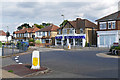
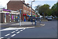
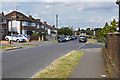
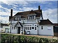

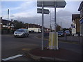
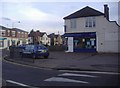
28 photos from this area
Area Information
Key information about the KT15 3BU including its size, population, and administrative classification.
- Area Type
- Postcode
- Area Size
- 1.2 hectares
- Population
- 1355
- Population Density
- 4733 people/km²
House Prices in KT15 3BU
28
Properties
£371,106
Average Sold Price
£79,800
Lowest Price
£567,000
Highest Price
Showing 28 properties
| Address | Type | Beds | Baths | Last Sale Price | Last Sale Date | |
|---|---|---|---|---|---|---|
| 22 Pinewood Grove, New Haw, KT15 3BU | Bungalow | 2 | 1 | £490,000 | Sep 2025 | |
| 20 Pinewood Grove, New Haw, KT15 3BU | Semi-detached | 2 | 1 | £450,000 | Dec 2024 | |
| 46 Pinewood Grove, New Haw, KT15 3BU | Bungalow | 2 | 1 | £475,000 | Mar 2024 | |
| 58 Pinewood Grove, New Haw, KT15 3BU | Terraced | 3 | 1 | £460,000 | Feb 2023 | |
| 52 Pinewood Grove, New Haw, KT15 3BU | Retail | 3 | 1 | £435,000 | Feb 2022 | |
| 38 Pinewood Grove, New Haw, KT15 3BU | Terraced | 3 | 1 | £385,000 | Jul 2020 | |
| 24 Pinewood Grove, New Haw, KT15 3BU | Bungalow | 4 | 2 | £542,000 | Jun 2016 | |
| 45A Pinewood Grove, New Haw, KT15 3BU | house | - | - | £567,000 | Jun 2016 | |
| 26 Pinewood Grove, New Haw, KT15 3BU | Semi-detached | 4 | 2 | £417,000 | Apr 2013 | |
| 28 Pinewood Grove, New Haw, KT15 3BU | house | 4 | - | £425,500 | May 2010 |
Page 1 of 3
Energy Efficiency in KT15 3BU
Amenities
Schools
| Rank | School | Type | Entry gender | Ages |
|---|
Explore more schools in this area
Go to Schools tabDemographics
Household Size
Family (3-5 people)
most common
Accommodation Type
Houses
most common
Tenure
73
majority
Ethnic Group
White
most common
Religion
N/A
most common
Household Composition
N/A
most common
Age
47
median
Adults (30-64 years)
most common
Household Deprivation
N/A
with no deprivation
NS-SEC
35
in Lower managerial occupations
Explore more demographic insights in this area
Go to Demographics tabPlanning
Planning Constraints
- Flood RiskPremium
- Ramsar Wetland SitesPremium
- Area of Outstanding Natural BeautyPremium
- Protected Nature ReservePremium
- Protected WoodlandPremium