Area Overview for KT15 1TF
Photos of KT15 1TF
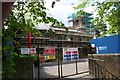
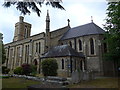
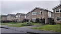
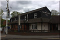
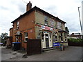
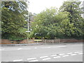
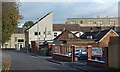
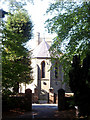


49 photos from this area
Area Information
Key information about the KT15 1TF including its size, population, and administrative classification.
- Area Type
- Postcode
- Area Size
- 3.4 hectares
- Population
- 1330
- Population Density
- 3510 people/km²
House Prices in KT15 1TF
44
Properties
£412,730
Average Sold Price
£187,000
Lowest Price
£710,000
Highest Price
Showing 44 properties
| Address | Type | Beds | Baths | Last Sale Price | Last Sale Date | |
|---|---|---|---|---|---|---|
| 117 School Lane, Addlestone, KT15 1TF | Detached | 4 | 1 | £710,000 | May 2025 | |
| 122 School Lane, Addlestone, KT15 1TF | Semi-detached | 2 | 1 | £405,000 | Sep 2024 | |
| 121 School Lane, Addlestone, KT15 1TF | Detached | 3 | 1 | £625,000 | Jan 2024 | |
| 116 School Lane, Addlestone, KT15 1TF | Bungalow | 3 | 2 | £570,000 | Mar 2023 | |
| 132 School Lane, Addlestone, KT15 1TF | Semi-detached | 3 | 2 | £525,000 | Apr 2022 | |
| 171 School Lane, Addlestone, KT15 1TF | Detached | 4 | - | £630,000 | Sep 2021 | |
| 141 School Lane, Addlestone, KT15 1TF | Detached | 2 | 1 | £358,500 | Feb 2021 | |
| 133 School Lane, Addlestone, KT15 1TF | Detached | 4 | 2 | £470,000 | Jan 2020 | |
| 167 School Lane, Addlestone, KT15 1TF | Semi-detached | 2 | 1 | £374,950 | Apr 2017 | |
| 163 School Lane, Addlestone, KT15 1TF | house | - | - | £445,000 | Feb 2017 |
Page 1 of 5
Energy Efficiency in KT15 1TF
Amenities
Schools
| Rank | School | Type | Entry gender | Ages |
|---|
Explore more schools in this area
Go to Schools tabDemographics
Household Size
Family (3-5 people)
most common
Accommodation Type
Houses
most common
Tenure
59
majority
Ethnic Group
White
most common
Religion
N/A
most common
Household Composition
N/A
most common
Age
47
median
Adults (30-64 years)
most common
Household Deprivation
N/A
with no deprivation
NS-SEC
28
in Lower managerial occupations
Explore more demographic insights in this area
Go to Demographics tabPlanning
Planning Constraints
- Flood RiskPremium
- Ramsar Wetland SitesPremium
- Area of Outstanding Natural BeautyPremium
- Protected Nature ReservePremium
- Protected WoodlandPremium