Area Overview for KT15 1SF
Photos of KT15 1SF
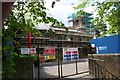
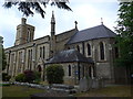
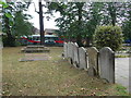
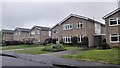
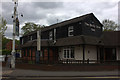
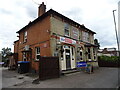
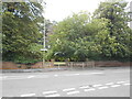
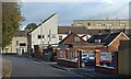
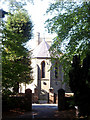
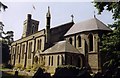
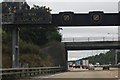
49 photos from this area
Area Information
Key information about the KT15 1SF including its size, population, and administrative classification.
- Area Type
- Postcode
- Area Size
- 1.5 hectares
- Population
- 2196
- Population Density
- 6835 people/km²
House Prices in KT15 1SF
38
Properties
£321,679
Average Sold Price
£81,500
Lowest Price
£632,000
Highest Price
Showing 38 properties
| Address | Type | Beds | Baths | Last Sale Price | Last Sale Date | |
|---|---|---|---|---|---|---|
| 103 Church Road, Addlestone, KT15 1SF | house | 2 | 1 | £390,000 | Oct 2021 | |
| 69 Church Road, Addlestone, KT15 1SF | Detached | 3 | 2 | £632,000 | Oct 2020 | |
| 93 Church Road, Addlestone, KT15 1SF | Semi-detached | 3 | 1 | £432,000 | Mar 2019 | |
| 89 Church Road, Addlestone, KT15 1SF | Semi-detached | 3 | 2 | £379,000 | Oct 2018 | |
| 87 Church Road, Addlestone, KT15 1SF | Semi-detached | 3 | 1 | £352,000 | Jun 2018 | |
| 111 Church Road, Addlestone, KT15 1SF | Semi-detached | 3 | 2 | £460,000 | Feb 2018 | |
| 81 Church Road, Addlestone, KT15 1SF | house | 1 | 1 | £430,000 | May 2017 | |
| 63 Church Road, Addlestone, KT15 1SF | Detached | 4 | 2 | £389,000 | Aug 2011 | |
| 101 Church Road, Addlestone, KT15 1SF | Terraced | - | - | £235,000 | Nov 2009 | |
| 99 Church Road, Addlestone, KT15 1SF | Semi-detached | - | - | £287,000 | May 2006 |
Page 1 of 4
Energy Efficiency in KT15 1SF
Amenities
Schools
| Rank | School | Type | Entry gender | Ages |
|---|
Explore more schools in this area
Go to Schools tabDemographics
Household Size
One person
most common
Accommodation Type
Flats
most common
Tenure
45
majority
Ethnic Group
White
most common
Religion
N/A
most common
Household Composition
N/A
most common
Age
47
median
Adults (30-64 years)
most common
Household Deprivation
N/A
with no deprivation
NS-SEC
31
in Lower managerial occupations
Explore more demographic insights in this area
Go to Demographics tabPlanning
Planning Constraints
- Flood RiskPremium
- Ramsar Wetland SitesPremium
- Area of Outstanding Natural BeautyPremium
- Protected Nature ReservePremium
- Protected WoodlandPremium