Area Overview for KT15 1FJ
Photos of KT15 1FJ
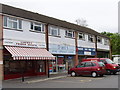

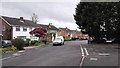
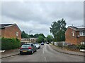
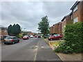


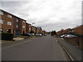
30 photos from this area
Area Information
Key information about the KT15 1FJ including its size, population, and administrative classification.
- Area Type
- Postcode
- Area Size
- 20.1 hectares
- Population
- 2725
- Population Density
- 3420 people/km²
House Prices in KT15 1FJ
49
Properties
£250,792
Average Sold Price
£146,000
Lowest Price
£350,000
Highest Price
Showing 49 properties
| Address | Type | Beds | Baths | Last Sale Price | Last Sale Date | |
|---|---|---|---|---|---|---|
| 193 Strawberry Fields, Addlestone, KT15 1FJ | house | - | - | £255,750 | Dec 2022 | |
| 160 Strawberry Fields, Addlestone, KT15 1FJ | Semi-detached | 2 | 2 | £350,000 | Jan 2021 | |
| 201 Strawberry Fields, Addlestone, KT15 1FJ | Terraced | 2 | 3 | £262,500 | May 2019 | |
| 198 Strawberry Fields, Addlestone, KT15 1FJ | Terraced | 3 | - | £283,500 | Feb 2019 | |
| 203 Strawberry Fields, Addlestone, KT15 1FJ | house | - | - | £207,000 | Mar 2018 | |
| 156 Strawberry Fields, Addlestone, KT15 1FJ | house | - | - | £146,000 | May 2016 | |
| 184 Strawberry Fields, Addlestone, KT15 1FJ | Terraced | 3 | 1 | - | - | |
| 144 Strawberry Fields, Addlestone, KT15 1FJ | house | - | - | - | - | |
| 146 Strawberry Fields, Addlestone, KT15 1FJ | house | - | - | - | - | |
| 148 Strawberry Fields, Addlestone, KT15 1FJ | house | - | - | - | - |
Page 1 of 5
Energy Efficiency in KT15 1FJ
Amenities
Schools
| Rank | School | Type | Entry gender | Ages |
|---|
Explore more schools in this area
Go to Schools tabDemographics
Household Size
Family (3-5 people)
most common
Accommodation Type
Houses
most common
Tenure
77
majority
Ethnic Group
White
most common
Religion
N/A
most common
Household Composition
N/A
most common
Age
47
median
Adults (30-64 years)
most common
Household Deprivation
N/A
with no deprivation
NS-SEC
38
in Lower managerial occupations
Explore more demographic insights in this area
Go to Demographics tabPlanning
Planning Constraints
- Flood RiskPremium
- Ramsar Wetland SitesPremium
- Area of Outstanding Natural BeautyPremium
- Protected Nature ReservePremium
- Protected WoodlandPremium