Area Overview for KT14 7TF
Photos of KT14 7TF
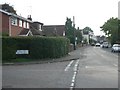
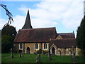
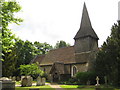

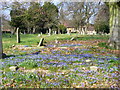
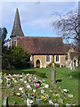
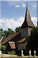

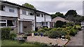
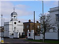
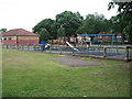
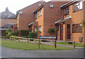
38 photos from this area
Area Information
Key information about the KT14 7TF including its size, population, and administrative classification.
- Area Type
- Postcode
- Area Size
- 6109 m²
- Population
- 1476
- Population Density
- 2247 people/km²
House Prices in KT14 7TF
19
Properties
£323,232
Average Sold Price
£125,000
Lowest Price
£525,000
Highest Price
Showing 19 properties
| Address | Type | Beds | Baths | Last Sale Price | Last Sale Date | |
|---|---|---|---|---|---|---|
| 19 Edward Ii Avenue, Byfleet, West Byfleet, KT14 7TF | Semi-detached | 3 | 1 | £427,500 | Jan 2025 | |
| 6 Edward Ii Avenue, Byfleet, West Byfleet, KT14 7TF | Semi-detached | 4 | 2 | £525,000 | Aug 2024 | |
| 15 Edward Ii Avenue, Byfleet, West Byfleet, KT14 7TF | Semi-detached | 3 | - | £483,751 | Sep 2022 | |
| 17 Edward Ii Avenue, Byfleet, West Byfleet, KT14 7TF | Semi-detached | 3 | - | £500,000 | Oct 2021 | |
| 2 Edward Ii Avenue, Byfleet, West Byfleet, KT14 7TF | Semi-detached | 3 | 1 | £375,000 | Sep 2018 | |
| 9 Edward Ii Avenue, Byfleet, West Byfleet, KT14 7TF | Semi-detached | 4 | 3 | £450,000 | May 2018 | |
| 23 Edward Ii Avenue, Byfleet, West Byfleet, KT14 7TF | Semi-detached | 3 | 1 | £350,000 | Jul 2015 | |
| 5 Edward Ii Avenue, Byfleet, West Byfleet, KT14 7TF | Semi-detached | 3 | 2 | £250,000 | Sep 2011 | |
| 11 Edward Ii Avenue, Byfleet, West Byfleet, KT14 7TF | house | 3 | - | £264,000 | Jan 2011 | |
| 25 Edward Ii Avenue, Byfleet, West Byfleet, KT14 7TF | house | - | - | £244,000 | Apr 2010 |
Page 1 of 2
Energy Efficiency in KT14 7TF
Amenities
Schools
| Rank | School | Type | Entry gender | Ages |
|---|
Explore more schools in this area
Go to Schools tabDemographics
Household Size
Family (3-5 people)
most common
Accommodation Type
Houses
most common
Tenure
86
majority
Ethnic Group
White
most common
Religion
N/A
most common
Household Composition
N/A
most common
Age
47
median
Adults (30-64 years)
most common
Household Deprivation
N/A
with no deprivation
NS-SEC
37
in Lower managerial occupations
Explore more demographic insights in this area
Go to Demographics tabPlanning
Planning Constraints
- Flood RiskPremium
- Ramsar Wetland SitesPremium
- Area of Outstanding Natural BeautyPremium
- Protected Nature ReservePremium
- Protected WoodlandPremium