Area Overview for KT14 7PL
Photos of KT14 7PL
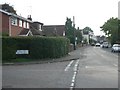
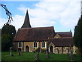
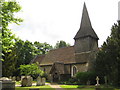

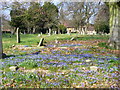

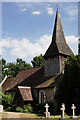

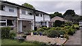
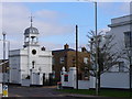
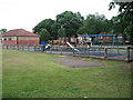
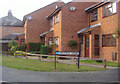
38 photos from this area
Area Information
Key information about the KT14 7PL including its size, population, and administrative classification.
- Area Type
- Postcode
- Area Size
- 6193 m²
- Population
- 1638
- Population Density
- 5406 people/km²
House Prices in KT14 7PL
14
Properties
£447,561
Average Sold Price
£244,000
Lowest Price
£650,000
Highest Price
Showing 14 properties
| Address | Type | Beds | Baths | Last Sale Price | Last Sale Date | |
|---|---|---|---|---|---|---|
| 42 Brewery Lane, Byfleet, West Byfleet, KT14 7PL | Semi-detached | 3 | 2 | £600,000 | Mar 2025 | |
| 24 Brewery Lane, Byfleet, West Byfleet, KT14 7PL | Bungalow | 4 | 2 | £650,000 | Dec 2024 | |
| 38 Brewery Lane, Byfleet, West Byfleet, KT14 7PL | Semi-detached | 3 | 1 | £565,000 | Oct 2020 | |
| 26 Brewery Lane, Byfleet, West Byfleet, KT14 7PL | Semi-detached | 3 | 1 | £390,000 | Jul 2017 | |
| 44 Brewery Lane, Byfleet, West Byfleet, KT14 7PL | Semi-detached | 3 | 1 | £400,000 | Jul 2017 | |
| 28 Brewery Lane, Byfleet, West Byfleet, KT14 7PL | house | - | - | £386,486 | Nov 2014 | |
| 40 Brewery Lane, Byfleet, West Byfleet, KT14 7PL | Semi-detached | 4 | 2 | £345,000 | Aug 2014 | |
| 34 Brewery Lane, Byfleet, West Byfleet, KT14 7PL | house | 3 | - | £244,000 | Feb 2012 | |
| Sewage Pumping Station Adj 31, Brewery Lane, Byfleet, West Byfleet, KT14 7PL | Industrial | - | - | - | - | |
| 30 Brewery Lane, Byfleet, West Byfleet, KT14 7PL | Semi-detached | - | - | - | - |
Page 1 of 2
Energy Efficiency in KT14 7PL
Amenities
Schools
| Rank | School | Type | Entry gender | Ages |
|---|
Explore more schools in this area
Go to Schools tabDemographics
Household Size
Family (3-5 people)
most common
Accommodation Type
Houses
most common
Tenure
83
majority
Ethnic Group
White
most common
Religion
N/A
most common
Household Composition
N/A
most common
Age
47
median
Adults (30-64 years)
most common
Household Deprivation
N/A
with no deprivation
NS-SEC
41
in Lower managerial occupations
Explore more demographic insights in this area
Go to Demographics tabPlanning
Planning Constraints
- Flood RiskPremium
- Ramsar Wetland SitesPremium
- Area of Outstanding Natural BeautyPremium
- Protected Nature ReservePremium
- Protected WoodlandPremium