Area Overview for KT14 6LF
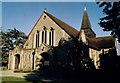
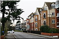
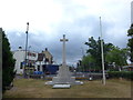
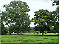
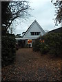
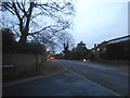
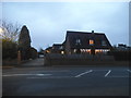
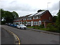
Photos of KT14 6LF
Area Information
KT14 6LF is a compact residential cluster covering just 2,871 square metres in the borough of Elmbridge. You are living within a small, defined postcode area where 2,259 people call home. This high density creates an immediate sense of community, though the physical space itself is limited by its specific boundaries. Residents here find themselves situated in Greater London yet remain connected to the wider Surrey network through established transport links. Daily life in KT14 6LF revolves around proximity to key hubs like Fairoaks Airport and the major rail stations of West Byfleet and Byfleet & New Haw. The area functions as a practical residential node, balancing suburban convenience with urban connectivity. You do not require a car to access your daily essentials, as five supermarkets and several railway stations fall within easy reach. The population density of 786,847 people per square kilometre suggests a built-up environment where neighbours are likely close at hand. This setting suits those who value accessibility over sprawling gardens or vast immediate surroundings. Living in KT14 6LF means accepting a shared space where services are centralised and transport options are plentiful. It is a location for those who prioritise getting to work or school quickly rather than enjoying a secluded, expansive estate.
- Area Type
- Postcode
- Area Size
- 2871 m²
- Population
- 2259
- Population Density
- 3769 people/km²
The property market in KT14 6LF is defined by a significant ownership rate of 58%. This figure demonstrates that the majority of properties are owner-occupied, creating a stable residential foundation. Consequently, you are likely to find a mix of long-term owners who may or may not be moving at any given moment, rather than a high turnover of tenants. The accommodation type is predominantly flats, which constrains the type of buyer to those living in converted buildings or purpose-built blocks suitable for this specific postcode. Because the area covers only 2,871 square metres, your options for new-build developments or large standalone homes are limited. You are essentially operating within an existing housing stock where the format is fixed. This reality means that buyers should look carefully at the specific units available within the local clusters rather than expecting standard suburban streetscapes. The high density of 786,847 people per square kilometre further reinforces the flat-centric nature of the market. If you are considering homes in KT14 6LF, expect to engage with a secondary or tertiary market where individual units hold the value rather than large new developments. This setup often appeals to those seeking established addresses over speculative building projects.
House Prices in KT14 6LF
Showing 12 properties
| Address | Type | Beds | Baths | Last Sale Price | Last Sale Date | |
|---|---|---|---|---|---|---|
| 55A Old Woking Road, West Byfleet, KT14 6LF | Maisonette | 2 | 1 | £245,000 | May 2025 | |
| 57A Old Woking Road, West Byfleet, KT14 6LF | Maisonette | - | - | £375,000 | Nov 2018 | |
| 73A Old Woking Road, West Byfleet, KT14 6LF | Flat | - | - | £190,000 | Aug 2000 | |
| 67 Old Woking Road, West Byfleet, KT14 6LF | Retail | - | - | - | - | |
| Chu Chin Chow, 63 Old Woking Road, West Byfleet, KT14 6LF | restaurant_cafe | - | - | - | - | |
| First To Third Floor Flat, 63A Old Woking Road, West Byfleet, KT14 6LF | Unknown | - | - | - | - | |
| Flat 1, 71 Old Woking Road, West Byfleet, KT14 6LF | Flat | - | - | - | - | |
| Flat, 53A Old Woking Road, West Byfleet, KT14 6LF | Flat | 2 | - | - | - | |
| Flat, 53B Old Woking Road, West Byfleet, KT14 6LF | Flat | - | - | - | - | |
| Rosemount Clinic Of Complimentary Medicines, 61A Old Woking Road, West Byfleet, KT14 6LF | commercial | - | - | - | - |
Energy Efficiency in KT14 6LF
Daily life in KT14 6LF is characterised by immediate access to essential services and transport hubs. You can reach five major retail locations within practical distance, including Waitrose West, Tesco Old Woking, and Co-op Pyrford. These supermarkets provide a complete range of groceries and daily necessities without the need for extensive travel. For commuters and leisure enthusiasts, rail connectivity remains a cornerstone of your routine. Five rail stations, such as West Byfleet and Byfleet & New Haw, are a short journey away, facilitating quick trips into London or Surrey towns. Wayside leisure options include access to Fairoaks Airport, which is often used for private aviation or leisure flying. River enthusiasts can utilize the Weybridge Ferry Landing and Shepperton Ferry Landing for scenic water crossings. These amenities create a lifestyle that balances urban convenience with countryside access. You can stock up on goods at Tesco Old Woking in the morning and commute via West Byfleet station in the afternoon. The presence of multiple transport modes and retail outlets ensures that your day-to-day needs are met efficiently. Living in KT14 6LF means you maintain a high quality of life through proximity rather than owning vast private estates.
Amenities
Schools
Families looking at KT14 6LF have access to strong state education options, though you should interpret these carefully given the flat-dominated accommodation type. The nearest primary education providers include West Byfleet Infant School and West Byfleet Junior School. Both institutions hold a 'good' Ofsted rating, which meets the government's standard for quality provision. You will find these schools within a practical commuting distance, allowing residents to balance local amenities with educational needs. While there are no secondary schools explicitly listed in this immediate vicinity, the presence of two primary schools with good ratings suggests a committed local education sector. Living in KT14 6LF means your children will start their education in well-regarded establishments that support early learning and development. The proximity of these schools ensures that parents do not need to travel far for front-line education. This arrangement fits well with the resident profile, as many households are in the 30 to 64 age bracket, a demographic that typically values local, high-standard schooling. When evaluating schools near KT14 6LF, focus on the accessible history of West Byfleet Infant School and West Byfleet Junior School to gauge the educational trajectory available to your household.
| Rank | School | Type | Entry gender | Ages |
|---|
Explore more schools in this area
Go to Schools tabDemographics
The community in KT14 6LF reflects a mature household profile with a median age of 47 years. The most common age range for residents falls between 30 and 64 years, indicating an area where families and empty nesters are the primary demographic groups. Home ownership stands at 58%, which means you are buying into a neighbourhood where a majority of residents have already secured their property or inherited it. This statistic often points to a stable environment with long-term residents rather than a transient rental market. Accommodation primarily consists of flats, meaning you are looking at multi-unit buildings rather than detached or semi-detached houses typical of the wider Surrey outskirts. This structural choice aligns with the small physical footprint of the postcode, which spans only 2,871 square metres. The predominant ethnic group is White, reflecting the broad demographic trend seen across much of southwest London and neighbouring Surrey. With a population of 2,259, the social fabric remains relatively tight, yet diverse enough to be part of the larger regional tapestry. Living in this area supports a lifestyle centred on established communities where privacy and interaction coexist within a high-density flat context.
Household Size
Accommodation Type
Tenure
Ethnic Group
Religion
Household Composition
Age
Household Deprivation
NS-SEC
Explore more demographic insights in this area
Go to Demographics tabPlanning
Planning Constraints
- Flood RiskPremium
- Ramsar Wetland SitesPremium
- Area of Outstanding Natural BeautyPremium
- Protected Nature ReservePremium
- Protected WoodlandPremium