Area Overview for KT14 6EY
Photos of KT14 6EY


Area Information
KT14 6EY is a compact residential postcode in England, spanning 71.1 hectares and home to 1,446 people. Its high population density of 2,033 people per square kilometre reflects a tightly knit community, where homes are closely spaced but still offer a quiet, suburban feel. The area is a small cluster of properties, predominantly houses, which cater to a demographic skewed towards adults aged 30–64. This suggests a mature, stable population with established roots. Living here means proximity to essential services: nearby rail stations, retail outlets, and a primary school. The area’s size and density make it a practical choice for those seeking a balance between residential tranquillity and easy access to daily amenities. Its location also benefits from proximity to Fairoaks Airport, offering connectivity to regional and international travel. However, the compact nature of KT14 6EY means its immediate surroundings are limited, requiring residents to venture slightly further for broader options. For those prioritising community cohesion and convenience, this postcode offers a focused, well-served environment.
- Area Type
- Postcode
- Area Size
- 71.1 hectares
- Population
- 1446
- Population Density
- 1981 people/km²
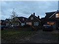
KT14 6EY is primarily a home-owning area, with 52% of properties occupied by owners. The housing stock consists almost entirely of houses, indicating a lack of high-density or multi-unit developments. This makes the area more suited to families or individuals seeking larger, standalone homes rather than flats or apartments. The small size of the postcode means the property market is limited to a handful of homes, which could lead to competition among buyers. The high proportion of owner-occupied properties suggests a stable market with long-term residents, potentially reducing turnover. For buyers, this means limited immediate options but a chance to secure a property in a tightly held, established community. Those considering the area should also look to nearby postcode areas for additional housing stock, as KT14 6EY’s small size restricts expansion. The focus on houses also implies higher land values and potential challenges in finding properties that meet specific size or layout requirements.
House Prices in KT14 6EY
Showing 13 properties
| Address | Type | Beds | Baths | Last Sale Price | Last Sale Date | |
|---|---|---|---|---|---|---|
| Woodlands View West Hall, Parvis Road, West Byfleet, KT14 6EY | Detached | 4 | 3 | £1,230,000 | Mar 2018 | |
| 3, The Stables, Parvis Road, West Byfleet, KT14 6EY | Terraced | 1 | - | £285,000 | Oct 2015 | |
| Vermont Lodge West Hall, Parvis Road, West Byfleet, KT14 6EY | Detached | - | - | £720,000 | Dec 2009 | |
| 2, The Stables, Parvis Road, West Byfleet, KT14 6EY | Terraced | 4 | 2 | - | - | |
| 4, The Stables, Parvis Road, West Byfleet, KT14 6EY | Bungalow | 2 | 1 | - | - | |
| Anchor, West Hall Care Home, Parvis Road, West Byfleet, KT14 6EY | Detached | 4 | 3 | - | - | |
| 1, The Stables, Parvis Road, West Byfleet, KT14 6EY | Semi-detached | 4 | - | - | - | |
| Caretakers Cottage, West Hall Mouchel And Partners, Parvis Road, West Byfleet, KT14 6EY | undefined | - | - | - | - | |
| 2, Farm Cottage West Hall, Parvis Road, West Byfleet, KT14 6EY | Detached | - | - | - | - | |
| Busy Bees, West Hall, Parvis Road, Byfleet, West Byfleet, KT14 6EY | hospital_care_home | - | - | - | - |
Energy Efficiency in KT14 6EY
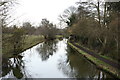
Residents of KT14 6EY have access to a range of nearby amenities, including five retail outlets such as Co-op Byfleet, Waitrose West, and Tesco Old Woking, ensuring everyday shopping needs are met. The area’s rail stations provide convenient links to larger towns, while Fairoaks Airport offers regional travel options. Two ferry landings, Weybridge and Shepperton, provide water-based transport links, adding to the area’s connectivity. The presence of these amenities fosters a practical lifestyle, with easy access to food, transport, and travel. However, the small size of KT14 6EY means leisure and cultural options are limited to nearby towns. The mix of retail and transport infrastructure supports a self-sufficient daily life, though residents may need to venture further for specialist services. The area’s proximity to natural features, such as protected woodland, also offers opportunities for outdoor recreation, though the lack of parks or green spaces within the postcode itself is notable.
Amenities
Schools
The nearest school to KT14 6EY is St Mary’s CofE Controlled Primary School in Byfleet, which holds a ‘good’ Ofsted rating. This primary school serves the local community, offering education for younger children. The absence of secondary schools in the immediate area means families may need to consider commuting to nearby towns for secondary education. The presence of a well-rated primary school is a significant draw for families, particularly those prioritising early education quality. However, the single school listed in the data suggests limited educational options for older children, which could be a consideration for households with multiple children. The school’s rating indicates a satisfactory standard of teaching and facilities, but parents may need to supplement with extracurricular activities or private schooling for older students. For those focused on primary education, St Mary’s provides a reliable foundation, though broader educational needs may require planning beyond the immediate postcode.
| Rank | School | Type | Entry gender | Ages |
|---|
Explore more schools in this area
Go to Schools tabDemographics
KT14 6EY’s population of 1,446 is predominantly adults aged 30–64, with a median age of 47. This indicates a mature, settled community, likely with strong family ties and established careers. Home ownership stands at 52%, suggesting a mix of owner-occupied properties and rental homes. The area is characterised by houses rather than flats, aligning with its suburban nature. The predominant ethnic group is White, reflecting a homogenous demographic profile. The high population density of 2,033 people per square kilometre means the area is densely populated despite its small size, which could influence local dynamics such as school capacity and community interactions. While no specific deprivation data is provided, the mix of home ownership and rental properties suggests a range of economic backgrounds. The absence of detailed diversity metrics means the community’s broader social composition remains less defined. For buyers, this demographic profile implies a stable, low-turnover market with residents prioritising long-term residency.
Household Size
Accommodation Type
Tenure
Ethnic Group
Religion
Household Composition
Age
Household Deprivation
NS-SEC
Explore more demographic insights in this area
Go to Demographics tabPlanning
Planning Constraints
- Flood RiskPremium
- Ramsar Wetland SitesPremium
- Area of Outstanding Natural BeautyPremium
- Protected Nature ReservePremium
- Protected WoodlandPremium