Area Overview for KT13 9YA
Photos of KT13 9YA
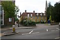
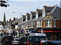
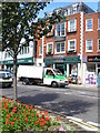
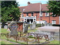
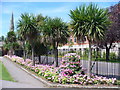
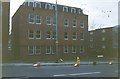
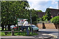

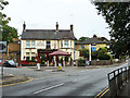
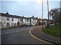
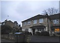

81 photos from this area
Area Information
Key information about the KT13 9YA including its size, population, and administrative classification.
- Area Type
- Postcode
- Area Size
- 4.6 hectares
- Population
- 1756
- Population Density
- 3314 people/km²
House Prices in KT13 9YA
25
Properties
£1,415,448
Average Sold Price
£260,000
Lowest Price
£2,500,000
Highest Price
Showing 25 properties
| Address | Type | Beds | Baths | Last Sale Price | Last Sale Date | |
|---|---|---|---|---|---|---|
| 5 Churchfields Avenue, Weybridge, KT13 9YA | Retail | 5 | 3 | £2,500,000 | Dec 2021 | |
| 14 Churchfields Avenue, Weybridge, KT13 9YA | house | - | - | £1,650,000 | Oct 2020 | |
| 8B Churchfields Avenue, Weybridge, KT13 9YA | Detached | 5 | 3 | £1,265,000 | Jul 2019 | |
| Orchard Lodge, 8A Churchfields Avenue, Weybridge, KT13 9YA | house | - | - | £1,050,000 | Dec 2015 | |
| 15 Churchfields Avenue, Weybridge, KT13 9YA | house | - | - | £1,950,000 | Feb 2012 | |
| 9 Churchfields Avenue, Weybridge, KT13 9YA | house | - | - | £1,725,000 | Jan 2012 | |
| 7 Churchfields Avenue, Weybridge, KT13 9YA | house | - | - | £2,100,000 | Dec 2011 | |
| 1A Churchfields Avenue, Weybridge, KT13 9YA | house | - | - | £504,480 | Mar 2009 | |
| Spires View, 8C Churchfields Avenue, Weybridge, KT13 9YA | Detached | 4 | 3 | £1,150,000 | May 2007 | |
| 20 Churchfields Avenue, Weybridge, KT13 9YA | Detached | - | - | £260,000 | Nov 1996 |
Page 1 of 3
Energy Efficiency in KT13 9YA
Amenities
Schools
| Rank | School | Type | Entry gender | Ages |
|---|
Explore more schools in this area
Go to Schools tabDemographics
Household Size
One person
most common
Accommodation Type
Houses
most common
Tenure
62
majority
Ethnic Group
White
most common
Religion
N/A
most common
Household Composition
N/A
most common
Age
47
median
Adults (30-64 years)
most common
Household Deprivation
N/A
with no deprivation
NS-SEC
50
in Lower managerial occupations
Explore more demographic insights in this area
Go to Demographics tabPlanning
Planning Constraints
- Flood RiskPremium
- Ramsar Wetland SitesPremium
- Area of Outstanding Natural BeautyPremium
- Protected Nature ReservePremium
- Protected WoodlandPremium