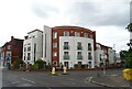
Area Overview for KT13 9PN
Photos of KT13 9PN


Area Information
KT13 9PN is a small, tightly knit residential area in England, home to 1,669 residents. It occupies a compact footprint, typical of its postcode classification, and is characterised by a quiet, suburban atmosphere. The area’s demographic profile suggests a mature community, with a median age of 47 and a strong presence of adults aged 30–64. This suggests a stable, family-oriented environment, with many residents likely to be homeowners. The area’s proximity to Weybridge and Shepperton offers easy access to local amenities, while its low crime risk and robust digital connectivity make it appealing for professionals and families. With 83% of homes owned by residents, the area leans towards owner-occupation, reflecting a sense of permanence. Daily life here is shaped by nearby retail hubs, rail links, and proximity to two airports, blending suburban comfort with practical connectivity. The absence of major environmental constraints, such as protected woodlands or AONB designations, adds to its liveability. For those seeking a balanced mix of convenience and tranquillity, KT13 9PN presents a compelling case.
- Area Type
- Postcode
- Area Size
- Not available
- Population
- 1669
- Population Density
- 2971 people/km²
KT13 9PN is largely an owner-occupied area, with 83% of homes owned by residents. The accommodation type is predominantly houses, which is unusual for a small postcode area but suggests a focus on family-friendly properties. This mix indicates a market where long-term residency is common, with fewer rental properties available. For buyers, this means a limited selection of properties, as the area is small and the housing stock is concentrated. The predominance of houses may appeal to those seeking space and privacy, though the lack of flats could limit options for certain buyers. The area’s proximity to Weybridge and Shepperton may offer additional opportunities for those willing to consider nearby suburbs. Overall, the property market here is stable but niche, requiring careful consideration of location and availability.
House Prices in KT13 9PN
No properties found in this postcode.
Energy Efficiency in KT13 9PN
Residents of KT13 9PN enjoy a range of amenities within practical reach. The retail sector includes major supermarkets such as Tesco Weybridge, Sainsburys Weybridge, and Morrisons Weybridge, ensuring everyday shopping needs are met. For transport, the area is linked to multiple rail stations and ferry landings, facilitating easy travel to nearby towns and cities. The proximity to Fairoaks and Heathrow airports also caters to those with travel or work commitments. While the data does not specify leisure or dining options, the availability of retail and transport hubs suggests a functional lifestyle focused on convenience and connectivity. The absence of detailed information on parks or recreational facilities means buyers should explore the area further for a full picture of its amenities.
Amenities
Schools
Residents of KT13 9PN have access to two primary schools within practical reach: Oatlands School and St James CofE Primary School. Both institutions hold a ‘good’ Ofsted rating, indicating a reliable standard of education. The presence of two primary schools provides families with choice, though no secondary schools are listed in the data. This suggests that students may need to travel to nearby towns for secondary education, such as Weybridge or Shepperton. The proximity of these schools to residential areas enhances the area’s appeal for families, ensuring children have access to quality early education. However, the absence of detailed information on school capacity or catchment areas means potential buyers should verify suitability for their specific needs.
| Rank | School | Type | Entry gender | Ages |
|---|
Explore more schools in this area
Go to Schools tabDemographics
The community in KT13 9PN is predominantly composed of adults aged 30–64, with a median age of 47. This indicates a mature population, likely with established careers and family commitments. Home ownership is high, at 83%, suggesting a stable housing market and long-term residency. The area’s accommodation is primarily houses, reflecting a preference for family homes over flats. The predominant ethnic group is White, which aligns with broader regional trends. While no specific data on deprivation is provided, the high home ownership rate and low crime risk imply a relatively affluent and secure environment. The absence of detailed diversity metrics means the community’s full demographic profile remains partially unexplored, but the available figures paint a picture of a settled, middle-aged population with strong ties to their homes.
Household Size
Accommodation Type
Tenure
Ethnic Group
Religion
Household Composition
Age
Household Deprivation
NS-SEC
Explore more demographic insights in this area
Go to Demographics tabPlanning
Planning Constraints
- Flood RiskPremium
- Ramsar Wetland SitesPremium
- Area of Outstanding Natural BeautyPremium
- Protected Nature ReservePremium
- Protected WoodlandPremium