Area Overview for KT13 0JE
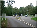
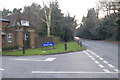
Photos of KT13 0JE


Area Information
KT13 0JE is a small residential cluster in England, home to 1720 people. Its compact size fosters a close-knit community, with daily life centred around local amenities and nearby transport links. The area’s character is defined by its mix of established homes and proximity to Weybridge, a town known for its historic charm. Residents benefit from easy access to shops, rail services, and ferry routes, making it convenient for commuters and families alike. The median age of 47 suggests a stable population, with many residents in their prime working years. This area is ideal for those seeking a balance between suburban comfort and accessibility to larger towns. While small, KT13 0JE offers a practical lifestyle, with homes primarily in private ownership and a low crime risk. Its location near Weybridge and Hersham railway stations ensures connectivity to London and surrounding areas, while nearby ferry services provide alternative travel options. The area’s compact nature means residents are close to essential services, yet it remains distinct from larger urban centres.
- Area Type
- Postcode
- Area Size
- Not available
- Population
- 1720
- Population Density
- 2219 people/km²
KT13 0JE is predominantly an owner-occupied area, with 74% of homes in private hands. The accommodation type is primarily houses, suggesting a mix of detached and semi-detached properties. This contrasts with areas dominated by rental properties or flats, indicating a community of long-term residents rather than transient tenants. The small size of the postcode means the housing stock is limited, but the focus on houses may appeal to families seeking space. Buyers should consider the immediate surrounding areas for more options, as the cluster itself is compact. The high home ownership rate also implies stable property values, though specific market trends are not provided. For those seeking a traditional, low-density neighbourhood, KT13 0JE offers a blend of established homes and proximity to Weybridge’s amenities.
House Prices in KT13 0JE
No properties found in this postcode.
Energy Efficiency in KT13 0JE
Living in KT13 0JE offers access to a range of amenities within practical reach. Retail options include major chains like Tesco Weybridge, Sainsburys Weybridge, and Morrisons Weybridge, ensuring everyday shopping needs are met. The area’s proximity to Weybridge Railway Station and Hersham Railway Station provides easy access to London and Surrey’s towns. Ferry services at Weybridge and Shepperton offer alternative travel routes, particularly for those using the Thames. Fairoaks Airport is nearby, adding convenience for regional travel. The presence of multiple retail outlets and transport hubs reflects a practical, commuter-friendly lifestyle. While the area is small, its connectivity to larger towns means residents can enjoy both local convenience and broader opportunities.
Amenities
Schools
| Rank | School | Type | Entry gender | Ages |
|---|
Explore more schools in this area
Go to Schools tabDemographics
The population of KT13 0JE has a median age of 47, with the most common age range being adults aged 30–64. This suggests a community of working professionals and families, with fewer young or elderly residents. Home ownership is high at 74%, indicating a stable, long-term resident base. The predominant accommodation type is houses, reflecting a traditional, family-oriented housing stock. The predominant ethnic group is White, though specific diversity statistics are not provided. The age profile and home ownership rates imply a mature, settled population with lower turnover. This demographic structure supports a community focused on local amenities and long-term living. The absence of data on deprivation levels means no direct conclusions can be drawn about economic disparities, but the high home ownership rate generally correlates with financial stability.
Household Size
Accommodation Type
Tenure
Ethnic Group
Religion
Household Composition
Age
Household Deprivation
NS-SEC
Explore more demographic insights in this area
Go to Demographics tabPlanning
Planning Constraints
- Flood RiskPremium
- Ramsar Wetland SitesPremium
- Area of Outstanding Natural BeautyPremium
- Protected Nature ReservePremium
- Protected WoodlandPremium
- Crime RiskPremium