Area Overview for KT12 4HU
Photos of KT12 4HU


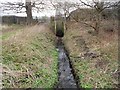
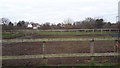
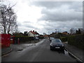


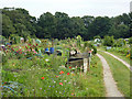

15 photos from this area
Area Information
Key information about the KT12 4HU including its size, population, and administrative classification.
- Area Type
- Postcode
- Area Size
- 3.1 hectares
- Population
- 1965
- Population Density
- 3201 people/km²
House Prices in KT12 4HU
36
Properties
£274,636
Average Sold Price
£91,500
Lowest Price
£575,000
Highest Price
Showing 36 properties
| Address | Type | Beds | Baths | Last Sale Price | Last Sale Date | |
|---|---|---|---|---|---|---|
| 71A Pleasant Place, Hersham, Walton On Thames, KT12 4HU | Terraced | 4 | - | £489,000 | Jan 2018 | |
| 70 Pleasant Place, Hersham, Walton On Thames, KT12 4HU | house | 3 | - | £575,000 | Jun 2016 | |
| 74 Pleasant Place, Hersham, Walton On Thames, KT12 4HU | Semi-detached | 3 | - | £492,000 | Jun 2016 | |
| 50 Pleasant Place, Hersham, Walton On Thames, KT12 4HU | Terraced | 4 | - | £435,000 | Jun 2014 | |
| 84 Pleasant Place, Hersham, Walton On Thames, KT12 4HU | Terraced | 4 | 1 | £305,000 | May 2006 | |
| 78 Pleasant Place, Hersham, Walton On Thames, KT12 4HU | Terraced | - | - | £112,500 | Jul 1999 | |
| 73 Pleasant Place, Hersham, Walton On Thames, KT12 4HU | Terraced | - | - | £140,000 | May 1999 | |
| 67A Pleasant Place, Hersham, Walton On Thames, KT12 4HU | Terraced | - | - | £141,000 | Dec 1998 | |
| 52 Pleasant Place, Hersham, Walton On Thames, KT12 4HU | Terraced | - | - | £118,000 | Jul 1998 | |
| 68 Pleasant Place, Hersham, Walton On Thames, KT12 4HU | Semi-detached | 2 | 1 | £122,000 | Jun 1998 |
Page 1 of 4
Energy Efficiency in KT12 4HU
Amenities
Schools
| Rank | School | Type | Entry gender | Ages |
|---|
Explore more schools in this area
Go to Schools tabDemographics
Household Size
One person
most common
Accommodation Type
Houses
most common
Tenure
72
majority
Ethnic Group
White
most common
Religion
N/A
most common
Household Composition
N/A
most common
Age
47
median
Adults (30-64 years)
most common
Household Deprivation
N/A
with no deprivation
NS-SEC
48
in Lower managerial occupations
Explore more demographic insights in this area
Go to Demographics tabPlanning
Planning Constraints
- Flood RiskPremium
- Ramsar Wetland SitesPremium
- Area of Outstanding Natural BeautyPremium
- Protected Nature ReservePremium
- Protected WoodlandPremium