Area Overview for KT12 4BX
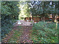
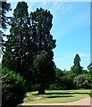
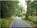
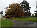
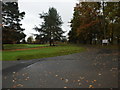
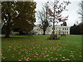
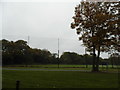
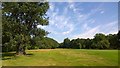
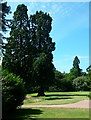
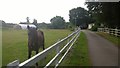
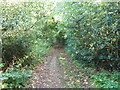
Photos of KT12 4BX
Area Information
Living in KT12 4BX offers a quiet, compact residential experience within a small cluster of homes. With a population of 1,500 and a density of 256 people per square kilometre, this area balances intimacy with practicality. The median age of 47 suggests a community leaning towards older residents, many of whom are in the 65+ age bracket. This demographic profile shapes a lifestyle centred on stability, with homes predominantly occupied by owners rather than renters. The area’s proximity to independent schools and transport links adds to its appeal for families seeking a mix of education options and connectivity. Daily life here is defined by easy access to retail, rail, and ferry services, while the absence of major environmental constraints ensures a straightforward living experience. For those prioritising safety and low risk, KT12 4BX’s low flood and crime scores offer reassurance. Its small size means amenities are within walking or short-driving distance, creating a self-contained environment that feels both private and well-served.
- Area Type
- Postcode
- Area Size
- Not available
- Population
- 1500
- Population Density
- 256 people/km²
The property market in KT12 4BX is dominated by owner-occupied homes, with 51% of properties owned by residents rather than rented. The accommodation type is primarily houses, which contrasts with areas where flats or apartments predominate. This suggests a market skewed towards family homes or larger properties, likely catering to older residents or those seeking space. The small size of the area means the housing stock is limited, potentially making it a competitive market for buyers. Proximity to independent schools and transport links adds to the area’s appeal, though the lack of nearby commercial hubs or high-density development may limit options for those seeking more diverse housing. For buyers, the focus should be on the quality of individual properties and their alignment with local amenities, as the immediate surroundings offer few alternatives.
House Prices in KT12 4BX
Showing 2 properties
| Address | Type | Beds | Baths | Last Sale Price | Last Sale Date | |
|---|---|---|---|---|---|---|
| Northern Practice Ground, Burhill Golf Club, Burhill, Hersham, Walton On Thames, KT12 4BX | Leisure | - | - | - | - | |
| Southern Practice Ground, Burhill Golf Club, Burhill, Hersham, Walton On Thames, KT12 4BX | Leisure | - | - | - | - |
Energy Efficiency in KT12 4BX
KT12 4BX’s lifestyle is defined by its proximity to a range of amenities within practical reach. Retail options include Sainsburys Cobham, Waitrose Hersham, and Lidl Molesey Road, providing access to everyday shopping. The area’s rail stations, ferry landings, and Fairoaks Airport ensure connectivity to wider destinations, while the absence of major environmental restrictions means residents can enjoy outdoor activities without constraints. The compact size of the area means amenities are never far, fostering a sense of convenience. For leisure, the nearby river and transport links to London offer opportunities for both relaxation and exploration. The mix of retail, transport, and natural access points creates a lifestyle that balances local simplicity with regional accessibility.
Amenities
Schools
KT12 4BX is served by three independent schools: Feltonfleet, Notre Dame School, and Notre Dame Preparatory School. These institutions cater to families seeking private education, offering a range of academic and extracurricular opportunities. The presence of multiple independent schools in the area provides options for different age groups and educational philosophies, though no data on Ofsted ratings or specific curricula is available. This concentration of private education may attract households prioritising non-state schooling, though it does not indicate the presence of state schools or alternative educational providers. Families should consider whether these schools align with their needs, as the area’s small size means alternatives are limited. The proximity of these schools to homes in KT12 4BX reinforces the area’s appeal for families.
| Rank | School | Type | Entry gender | Ages |
|---|
Explore more schools in this area
Go to Schools tabDemographics
KT12 4BX is characterised by a median age of 47, with the majority of residents aged 65 or older. This demographic suggests a community with a strong presence of retirees and long-term residents. Home ownership stands at 51%, indicating a mix of owner-occupied properties and rental homes, though the accommodation type is primarily houses rather than flats or apartments. The predominant ethnic group is White, reflecting a relatively homogenous population. With 1,500 residents, the area’s small size fosters a close-knit environment, though it lacks the diversity seen in larger urban centres. The absence of specific data on deprivation levels means it is difficult to assess broader quality-of-life factors, but the low crime risk score of 78 suggests a generally secure living environment. This profile may appeal to those seeking a settled, low-maintenance lifestyle with minimal disruption.
Household Size
Accommodation Type
Tenure
Ethnic Group
Religion
Household Composition
Age
Household Deprivation
NS-SEC
Explore more demographic insights in this area
Go to Demographics tabPlanning
Planning Constraints
- Flood RiskPremium
- Ramsar Wetland SitesPremium
- Area of Outstanding Natural BeautyPremium
- Protected Nature ReservePremium
- Protected WoodlandPremium