Area Overview for KT12 3PU
Photos of KT12 3PU
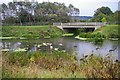
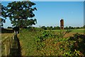

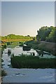


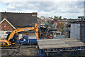

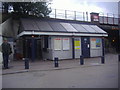
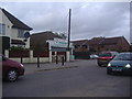
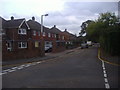
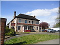
33 photos from this area
Area Information
Key information about the KT12 3PU including its size, population, and administrative classification.
- Area Type
- Postcode
- Area Size
- 8.7 hectares
- Population
- 1448
- Population Density
- 1346 people/km²
House Prices in KT12 3PU
21
Properties
-
Average Sold Price
-
Lowest Price
-
Highest Price
Showing 21 properties
| Address | Type | Beds | Baths | Last Sale Price | Last Sale Date | |
|---|---|---|---|---|---|---|
| Flat 1, Lyon Court, 31 Lyon Road, Walton On Thames, KT12 3PU | Flat | 2 | 1 | - | - | |
| Flat 14, Lyon Court, 31 Lyon Road, Walton On Thames, KT12 3PU | Flat | 1 | 1 | - | - | |
| Flat 2, Lyon Court, 31 Lyon Road, Walton On Thames, KT12 3PU | Flat | 1 | 1 | - | - | |
| Flat 12, Lyon Court, 31 Lyon Road, Walton On Thames, KT12 3PU | Flat | 1 | 1 | - | - | |
| 354 Molesey Road, Walton On Thames, KT12 3PU | Detached | - | - | - | - | |
| Darjeeling, 352 Molesey Road, Walton On Thames, KT12 3PU | Detached | - | - | - | - | |
| Bluepay Ltd, 25D Lyon Road, Walton On Thames, KT12 3PU | Industrial | - | - | - | - | |
| Hoil Dental Manufacture Solutions, 26C Lyon Road, Walton On Thames, KT12 3PU | office_workshop | - | - | - | - | |
| Bluebird Productions Ltd, 23 Lyon Road, Walton On Thames, KT12 3PU | general_industrial | - | - | - | - | |
| Flat 4, Lyon Court, 31 Lyon Road, Walton On Thames, KT12 3PU | Flat | - | - | - | - |
Page 1 of 3
Energy Efficiency in KT12 3PU
Amenities
Schools
| Rank | School | Type | Entry gender | Ages |
|---|
Explore more schools in this area
Go to Schools tabDemographics
Household Size
Family (3-5 people)
most common
Accommodation Type
Houses
most common
Tenure
83
majority
Ethnic Group
White
most common
Religion
N/A
most common
Household Composition
N/A
most common
Age
47
median
Adults (30-64 years)
most common
Household Deprivation
N/A
with no deprivation
NS-SEC
49
in Lower managerial occupations
Explore more demographic insights in this area
Go to Demographics tabPlanning
Planning Constraints
- Flood RiskPremium
- Ramsar Wetland SitesPremium
- Area of Outstanding Natural BeautyPremium
- Protected Nature ReservePremium
- Protected WoodlandPremium