Area Overview for KT12 3LL
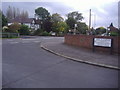
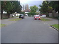
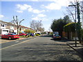
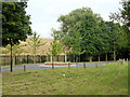
Photos of KT12 3LL


Area Information
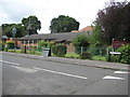
KT12 3LL is a small residential postcode in England, home to 1828 residents. It is a compact area characterised by a quiet, established community, with a focus on family-oriented living. The population is predominantly adults aged 30–64, reflecting a mature demographic that values stability. The area’s proximity to multiple primary schools, including Swansmere School and Walton Oak Primary School, makes it attractive for families. Residents benefit from a mix of local amenities, from retail outlets like Co-op Walton to transport links that connect to nearby railway stations and ferry services. While the area is small, it offers practical access to major infrastructure, including London Heathrow Airport, which is within reach. The postcode’s low flood risk and absence of environmental constraints suggest a safe, unencumbered living environment. However, the moderate crime risk score of 60 means standard security measures are advisable. KT12 3LL balances suburban tranquility with accessibility, making it a viable option for those seeking a settled, community-focused lifestyle.
- Area Type
- Postcode
- Area Size
- Not available
- Population
- 1828
- Population Density
- 8635 people/km²
KT12 3LL’s property market is defined by a 40% home ownership rate, suggesting that a majority of residents rent rather than own their homes. The accommodation type is primarily houses, which is unusual for a small postcode area but may reflect a focus on single-family dwellings. This mix of rental and owner-occupied properties indicates a dynamic market where buyers may need to look beyond the immediate postcode for available homes. The limited housing stock, combined with the area’s compact size, could create competition for properties. For buyers, this means considering nearby areas for more options, though KT12 3LL’s proximity to amenities and transport links may offset the need for larger searches. The predominance of houses also implies a preference for private, spacious living, which could appeal to families seeking a traditional suburban layout.
House Prices in KT12 3LL
Showing 1 properties
| Address | Type | Beds | Baths | Last Sale Price | Last Sale Date | |
|---|---|---|---|---|---|---|
| School House, Ambleside School, Ambleside Avenue, Walton On Thames, KT12 3LL | Detached | - | - | - | - |
Energy Efficiency in KT12 3LL
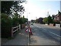
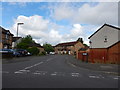
Living in KT12 3LL offers a blend of local retail and transport convenience. The area includes notable shops such as Co-op Walton and Tesco Molesey, providing everyday essentials. Residents can access five railway stations, three metro stops, and ferry landings, ensuring practical connectivity to nearby towns and London. The presence of multiple retail outlets, combined with proximity to major transport hubs, enhances the area’s appeal for those seeking a balance between convenience and community. While there is no mention of parks or leisure facilities in the data, the absence of environmental constraints like protected woodlands or AONB designations suggests open spaces may be available nearby. The mix of retail, transport, and proximity to Heathrow Airport creates a lifestyle that prioritises accessibility and practicality.
Amenities
Schools
KT12 3LL is served by several primary schools, including Swansmere School, Ambleside Junior School, and Walton Oak Primary School, which appears twice in the data. These institutions cater to young children, making the area well-suited for families with primary-aged students. The presence of multiple primary schools suggests a focus on early education, though no secondary schools are listed, which may require residents to travel to nearby areas for further schooling. The duplication of Walton Oak Primary School in the data may indicate a nearby cluster of educational facilities, but without Ofsted ratings or performance metrics, it is unclear how these schools compare. For families prioritising primary education, the proximity of these schools is a key advantage, though parents should investigate secondary school options separately.
| Rank | School | Type | Entry gender | Ages |
|---|
Explore more schools in this area
Go to Schools tabDemographics
The population of KT12 3LL has a median age of 47, with the majority of residents falling within the 30–64 age range. This suggests a community of middle-aged adults, likely with established careers and families. Home ownership rates are 40%, indicating that a significant portion of the population rents, possibly due to the area’s small size and limited housing stock. The predominant accommodation type is houses, which aligns with the residential cluster described in the postcode’s type description. The predominant ethnic group is White, with no specific data on other demographics provided. The absence of detailed diversity statistics means the community’s composition remains largely unexplored in this context. The age profile and home ownership figures imply a stable, long-term resident base, though the area’s small size may limit social diversity.
Household Size
Accommodation Type
Tenure
Ethnic Group
Religion
Household Composition
Age
Household Deprivation
NS-SEC
Explore more demographic insights in this area
Go to Demographics tabPlanning
Planning Constraints
- Flood RiskPremium
- Ramsar Wetland SitesPremium
- Area of Outstanding Natural BeautyPremium
- Protected Nature ReservePremium
- Protected WoodlandPremium