Area Overview for KT12 3JE
Photos of KT12 3JE

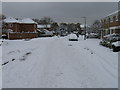

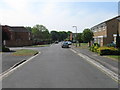
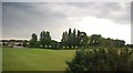
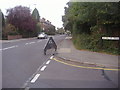
21 photos from this area
Area Information
Key information about the KT12 3JE including its size, population, and administrative classification.
- Area Type
- Postcode
- Area Size
- 1.4 hectares
- Population
- 1662
- Population Density
- 5094 people/km²
House Prices in KT12 3JE
19
Properties
£746,045
Average Sold Price
£240,000
Lowest Price
£1,225,000
Highest Price
Showing 19 properties
| Address | Type | Beds | Baths | Last Sale Price | Last Sale Date | |
|---|---|---|---|---|---|---|
| 45 Rydens Avenue, Walton On Thames, KT12 3JE | Semi-detached | 5 | 3 | £865,000 | Jan 2023 | |
| 57 Rydens Avenue, Walton On Thames, KT12 3JE | house | 4 | - | £835,000 | Jan 2021 | |
| 55 Rydens Avenue, Walton On Thames, KT12 3JE | Semi-detached | 3 | 2 | £890,000 | Dec 2020 | |
| 49 Rydens Avenue, Walton On Thames, KT12 3JE | house | - | - | £748,000 | Nov 2020 | |
| 59 Rydens Avenue, Walton On Thames, KT12 3JE | Semi-detached | 3 | 1 | £622,500 | Feb 2019 | |
| 37 Rydens Avenue, Walton On Thames, KT12 3JE | Bungalow | 3 | 1 | £725,000 | Mar 2017 | |
| 29B Rydens Avenue, Walton On Thames, KT12 3JE | Detached | 4 | 2 | £820,000 | Dec 2016 | |
| 31 Rydens Avenue, Walton On Thames, KT12 3JE | Detached | 4 | 2 | £1,225,000 | Aug 2015 | |
| 53 Rydens Avenue, Walton On Thames, KT12 3JE | Semi-detached | 3 | 2 | £489,950 | Nov 2009 | |
| 61 Rydens Avenue, Walton On Thames, KT12 3JE | Semi-detached | 4 | 2 | £240,000 | Dec 2000 |
Page 1 of 2
Energy Efficiency in KT12 3JE
Amenities
Schools
| Rank | School | Type | Entry gender | Ages |
|---|
Explore more schools in this area
Go to Schools tabDemographics
Household Size
Family (3-5 people)
most common
Accommodation Type
Houses
most common
Tenure
85
majority
Ethnic Group
White
most common
Religion
N/A
most common
Household Composition
N/A
most common
Age
47
median
Adults (30-64 years)
most common
Household Deprivation
N/A
with no deprivation
NS-SEC
55
in Lower managerial occupations
Explore more demographic insights in this area
Go to Demographics tabPlanning
Planning Constraints
- Flood RiskPremium
- Ramsar Wetland SitesPremium
- Area of Outstanding Natural BeautyPremium
- Protected Nature ReservePremium
- Protected WoodlandPremium