Area Overview for KT12 2XF
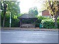
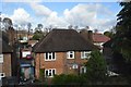
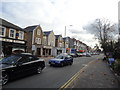
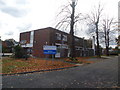
Photos of KT12 2XF


Area Information
Living in KT12 2XF means being part of a small, tightly knit residential cluster in England, home to 1,640 residents. The area’s compact size fosters a quiet, community-focused lifestyle, with homes predominantly owner-occupied and built as single-family houses. The median age of 47 suggests a stable population of adults in their prime working years, many of whom are likely to have established careers and families. Daily life here is shaped by proximity to essential services, including retail outlets like Tesco Walton and Sainsburys Walton, and transport links such as Walton and Hersham railway stations. The area’s low crime risk and absence of environmental constraints like protected woodlands or AONBs make it appealing for those seeking a safe, unobstructed living environment. Residents benefit from excellent digital connectivity, with a broadband score of 98, ensuring seamless access to online services. While the population is small, the mix of independent schools, rail networks, and ferry access to nearby towns like Shepperton and Weybridge creates a convenient, well-connected lifestyle for those who value both seclusion and accessibility.
- Area Type
- Postcode
- Area Size
- Not available
- Population
- 1640
- Population Density
- 2664 people/km²
The property market in KT12 2XF is characterised by high home ownership (81%) and a focus on single-family houses. This suggests the area is not a rental hotspot but rather a place where residents are likely to own their homes long-term. The prevalence of houses over flats or apartments indicates a preference for private, standalone living spaces, which may appeal to families or professionals seeking space and privacy. Given the small population and compact nature of the postcode, the housing stock is limited, meaning buyers should consider nearby areas for more options. The lack of planning constraints, such as protected woodlands or AONBs, may also make the area attractive for those seeking straightforward property transactions without environmental restrictions. However, the limited size of KT12 2XF itself means that the immediate surroundings are crucial for those looking to expand their search.
House Prices in KT12 2XF
No properties found in this postcode.
Energy Efficiency in KT12 2XF
Residents of KT12 2XF have access to a range of amenities within practical reach. The retail sector includes major chains like Tesco Walton, Sainsburys Walton, and Spar, ensuring everyday shopping needs are met. Rail stations such as Walton and Hersham provide regular commuter services, while ferry landings at Weybridge and Shepperton offer scenic and functional transport options. The presence of Heathrow Airport nearby adds to the area’s connectivity, though it is likely more relevant for travel than daily commuting. These amenities contribute to a lifestyle that balances convenience with the tranquillity of a smaller postcode. The mix of retail, transport, and river access suggests a community that values both practicality and the ability to explore nearby towns and natural landscapes.
Amenities
Schools
The nearest school to KT12 2XF is Westward School, an independent institution. Independent schools typically charge fees and may offer specialised curricula or smaller class sizes, though no Ofsted rating is provided in the data. The presence of a single independent school suggests that families in the area may prioritise private education, possibly due to the school’s reputation or proximity to other amenities. However, the absence of state schools in the data means that families relying on free education may need to look further afield. The school’s location within practical reach of residents highlights its accessibility, but the lack of additional educational institutions could be a consideration for those requiring multiple options.
| Rank | School | Type | Entry gender | Ages |
|---|
Explore more schools in this area
Go to Schools tabDemographics
The community in KT12 2XF is predominantly composed of adults aged 30–64, with a median age of 47. This suggests a population largely in their peak earning and family-raising years. Home ownership is high, at 81%, indicating a stable, long-term resident base rather than a transient rental market. The accommodation type is primarily houses, which aligns with the area’s small, residential character. The predominant ethnic group is White, though specific data on diversity or deprivation is not provided. The absence of detailed diversity metrics means the community profile remains broadly defined. The age range and home ownership figures suggest a population focused on stability, with fewer young families or elderly residents. This demographic profile may influence local amenities and services, which appear tailored to adult needs rather than those of children or retirees.
Household Size
Accommodation Type
Tenure
Ethnic Group
Religion
Household Composition
Age
Household Deprivation
NS-SEC
Explore more demographic insights in this area
Go to Demographics tabPlanning
Planning Constraints
- Flood RiskPremium
- Ramsar Wetland SitesPremium
- Area of Outstanding Natural BeautyPremium
- Protected Nature ReservePremium
- Protected WoodlandPremium