Area Overview for KT12 2QE
Photos of KT12 2QE
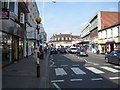
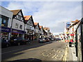
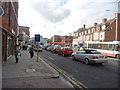
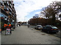
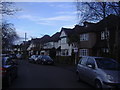
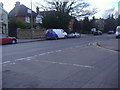
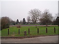
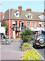

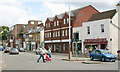
72 photos from this area
Area Information
Key information about the KT12 2QE including its size, population, and administrative classification.
- Area Type
- Postcode
- Area Size
- 1.8 hectares
- Population
- 1635
- Population Density
- 3874 people/km²
House Prices in KT12 2QE
55
Properties
£351,316
Average Sold Price
£108,000
Lowest Price
£540,000
Highest Price
Showing 55 properties
| Address | Type | Beds | Baths | Last Sale Price | Last Sale Date | |
|---|---|---|---|---|---|---|
| 36 Stonebanks, Walton On Thames, KT12 2QE | Semi-detached | 3 | 2 | £505,000 | Dec 2021 | |
| 21 Stonebanks, Walton On Thames, KT12 2QE | Semi-detached | 3 | 1 | £475,000 | Aug 2020 | |
| 20 Stonebanks, Walton On Thames, KT12 2QE | Semi-detached | 3 | - | £465,000 | May 2019 | |
| 46 Stonebanks, Walton On Thames, KT12 2QE | Semi-detached | 3 | 2 | £540,000 | Aug 2017 | |
| 4 Stonebanks, Walton On Thames, KT12 2QE | house | - | - | £495,000 | Jun 2016 | |
| 10 Stonebanks, Walton On Thames, KT12 2QE | house | - | - | £500,000 | Apr 2016 | |
| 30 Stonebanks, Walton On Thames, KT12 2QE | Semi-detached | 3 | - | £515,000 | Jan 2016 | |
| 27 Stonebanks, Walton On Thames, KT12 2QE | Terraced | 3 | 2 | £499,950 | Nov 2015 | |
| 2 Stonebanks, Walton On Thames, KT12 2QE | Terraced | 3 | 1 | £380,000 | Jul 2015 | |
| 23 Stonebanks, Walton On Thames, KT12 2QE | Semi-detached | 3 | - | £365,000 | Sep 2013 |
Page 1 of 6
Energy Efficiency in KT12 2QE
Amenities
Schools
| Rank | School | Type | Entry gender | Ages |
|---|
Explore more schools in this area
Go to Schools tabDemographics
Household Size
Two person
most common
Accommodation Type
Houses
most common
Tenure
80
majority
Ethnic Group
White
most common
Religion
N/A
most common
Household Composition
N/A
most common
Age
47
median
Adults (30-64 years)
most common
Household Deprivation
N/A
with no deprivation
NS-SEC
54
in Lower managerial occupations
Explore more demographic insights in this area
Go to Demographics tabPlanning
Planning Constraints
- Flood RiskPremium
- Ramsar Wetland SitesPremium
- Area of Outstanding Natural BeautyPremium
- Protected Nature ReservePremium
- Protected WoodlandPremium