Area Overview for KT12 2AF
Photos of KT12 2AF
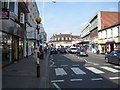
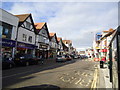
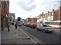
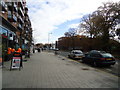
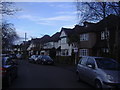
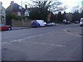
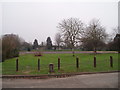
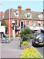
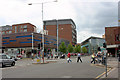
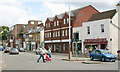
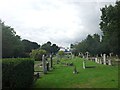
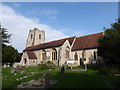
72 photos from this area
Area Information
Key information about the KT12 2AF including its size, population, and administrative classification.
- Area Type
- Postcode
- Area Size
- 5781 m²
- Population
- 1445
- Population Density
- 8898 people/km²
House Prices in KT12 2AF
18
Properties
£438,297
Average Sold Price
£121,500
Lowest Price
£700,000
Highest Price
Showing 18 properties
| Address | Type | Beds | Baths | Last Sale Price | Last Sale Date | |
|---|---|---|---|---|---|---|
| 104 Cottimore Avenue, Walton On Thames, KT12 2AF | house | - | - | £649,000 | Dec 2025 | |
| 79 Cottimore Avenue, Walton On Thames, KT12 2AF | Semi-detached | 4 | 2 | £700,000 | Feb 2025 | |
| 102 Cottimore Avenue, Walton On Thames, KT12 2AF | Semi-detached | 3 | 1 | £665,000 | Apr 2023 | |
| 94 Cottimore Avenue, Walton On Thames, KT12 2AF | Semi-detached | 3 | 1 | £592,000 | Jul 2022 | |
| 75 Cottimore Avenue, Walton On Thames, KT12 2AF | Semi-detached | 3 | 1 | £582,500 | Mar 2021 | |
| 71 Cottimore Avenue, Walton On Thames, KT12 2AF | Semi-detached | 4 | 1 | £572,500 | Aug 2019 | |
| 77 Cottimore Avenue, Walton On Thames, KT12 2AF | house | - | - | £585,000 | Feb 2016 | |
| 67 Cottimore Avenue, Walton On Thames, KT12 2AF | Semi-detached | 3 | 1 | £520,000 | Nov 2014 | |
| 108 Cottimore Avenue, Walton On Thames, KT12 2AF | Detached | 3 | 1 | £460,000 | Aug 2014 | |
| 81 Cottimore Avenue, Walton On Thames, KT12 2AF | Semi-detached | 3 | - | £385,000 | Sep 2012 |
Page 1 of 2
Energy Efficiency in KT12 2AF
Amenities
Schools
| Rank | School | Type | Entry gender | Ages |
|---|
Explore more schools in this area
Go to Schools tabDemographics
Household Size
Family (3-5 people)
most common
Accommodation Type
Houses
most common
Tenure
81
majority
Ethnic Group
White
most common
Religion
N/A
most common
Household Composition
N/A
most common
Age
47
median
Adults (30-64 years)
most common
Household Deprivation
N/A
with no deprivation
NS-SEC
44
in Lower managerial occupations
Explore more demographic insights in this area
Go to Demographics tabPlanning
Planning Constraints
- Flood RiskPremium
- Ramsar Wetland SitesPremium
- Area of Outstanding Natural BeautyPremium
- Protected Nature ReservePremium
- Protected WoodlandPremium