Area Overview for KT11 2NG
Photos of KT11 2NG
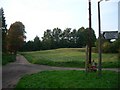
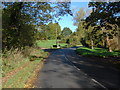
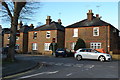
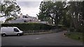
13 photos from this area
Area Information
Key information about the KT11 2NG including its size, population, and administrative classification.
- Area Type
- Postcode
- Area Size
- 3.9 hectares
- Population
- 1583
- Population Density
- 398 people/km²
House Prices in KT11 2NG
15
Properties
£3,399,376
Average Sold Price
£1,335,000
Lowest Price
£6,900,000
Highest Price
Showing 15 properties
| Address | Type | Beds | Baths | Last Sale Price | Last Sale Date | |
|---|---|---|---|---|---|---|
| 11 Icklingham Road, Cobham, KT11 2NG | Detached | 7 | 6 | £4,333,132 | Sep 2025 | |
| 5 Icklingham Road, Cobham, KT11 2NG | house | - | - | £6,900,000 | Mar 2024 | |
| 4 Icklingham Road, Cobham, KT11 2NG | Detached | 6 | 6 | £5,850,000 | Dec 2016 | |
| 10 Icklingham Road, Cobham, KT11 2NG | Detached | 6 | 6 | £3,675,000 | Dec 2015 | |
| 2 Icklingham Road, Cobham, KT11 2NG | Detached | 6 | 4 | £2,150,000 | Jun 2013 | |
| 14 Icklingham Road, Cobham, KT11 2NG | house | - | - | £4,500,000 | Aug 2012 | |
| 12 Icklingham Road, Cobham, KT11 2NG | house | - | - | £3,750,000 | Jul 2012 | |
| 9 Icklingham Road, Cobham, KT11 2NG | Detached | 5 | 6 | £1,720,000 | Nov 2010 | |
| 1 Icklingham Road, Cobham, KT11 2NG | Detached | - | - | £1,580,000 | Apr 2007 | |
| 8 Icklingham Road, Cobham, KT11 2NG | Detached | - | - | £1,600,000 | Jul 2006 |
Page 1 of 2
Energy Efficiency in KT11 2NG
Amenities
Schools
| Rank | School | Type | Entry gender | Ages |
|---|
Explore more schools in this area
Go to Schools tabDemographics
Household Size
Family (3-5 people)
most common
Accommodation Type
Houses
most common
Tenure
82
majority
Ethnic Group
White
most common
Religion
N/A
most common
Household Composition
N/A
most common
Age
47
median
Adults (30-64 years)
most common
Household Deprivation
N/A
with no deprivation
NS-SEC
48
in Lower managerial occupations
Explore more demographic insights in this area
Go to Demographics tabPlanning
Planning Constraints
- Flood RiskPremium
- Ramsar Wetland SitesPremium
- Area of Outstanding Natural BeautyPremium
- Protected Nature ReservePremium
- Protected WoodlandPremium