Area Overview for KT11 2JF
Photos of KT11 2JF
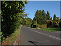
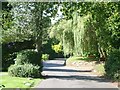
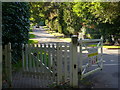
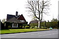
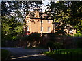
13 photos from this area
Area Information
Key information about the KT11 2JF including its size, population, and administrative classification.
- Area Type
- Postcode
- Area Size
- 3.2 hectares
- Population
- 1653
- Population Density
- 1328 people/km²
House Prices in KT11 2JF
21
Properties
£3,119,607
Average Sold Price
£1,500,000
Lowest Price
£4,950,000
Highest Price
Showing 21 properties
| Address | Type | Beds | Baths | Last Sale Price | Last Sale Date | |
|---|---|---|---|---|---|---|
| Acacia House, 19A Eaton Park, Cobham, KT11 2JF | Detached | 6 | 6 | £4,950,000 | Apr 2023 | |
| Laurel Wood, 17A Eaton Park, Cobham, KT11 2JF | house | - | - | £4,000,000 | Jun 2021 | |
| Regency House, 11A Eaton Park, Cobham, KT11 2JF | house | - | - | £3,887,250 | Apr 2021 | |
| Knightswood, 23 Eaton Park, Cobham, KT11 2JF | Detached | 6 | - | £2,300,000 | Jan 2019 | |
| Kings Beeches, 19 Eaton Park, Cobham, KT11 2JF | house | - | - | £2,750,000 | Dec 2016 | |
| Foxhill, 19B Eaton Park, Cobham, KT11 2JF | house | - | - | £1,500,000 | Oct 2016 | |
| 25 Eaton Park, Cobham, KT11 2JF | Detached | - | - | £2,450,000 | Jul 2009 | |
| 1 Eaton Park, Cobham, KT11 2JF | Detached | 6 | 9 | - | - | |
| 15 Eaton Park, Cobham, KT11 2JF | Detached | 5 | 6 | - | - | |
| Queen Anne House, 11 Eaton Park, Cobham, KT11 2JF | Detached | 5 | 3 | - | - |
Page 1 of 3
Energy Efficiency in KT11 2JF
Amenities
Schools
| Rank | School | Type | Entry gender | Ages |
|---|
Explore more schools in this area
Go to Schools tabDemographics
Household Size
Family (3-5 people)
most common
Accommodation Type
Houses
most common
Tenure
83
majority
Ethnic Group
White
most common
Religion
N/A
most common
Household Composition
N/A
most common
Age
47
median
Adults (30-64 years)
most common
Household Deprivation
N/A
with no deprivation
NS-SEC
60
in Lower managerial occupations
Explore more demographic insights in this area
Go to Demographics tabPlanning
Planning Constraints
- Flood RiskPremium
- Ramsar Wetland SitesPremium
- Area of Outstanding Natural BeautyPremium
- Protected Nature ReservePremium
- Protected WoodlandPremium