Area Overview for KT11 2EP
Photos of KT11 2EP
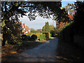
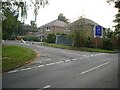
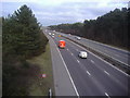
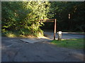
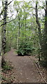
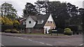
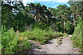
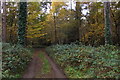

15 photos from this area
Area Information
Key information about the KT11 2EP including its size, population, and administrative classification.
- Area Type
- Postcode
- Area Size
- 3.2 hectares
- Population
- 1653
- Population Density
- 1328 people/km²
House Prices in KT11 2EP
23
Properties
£1,815,545
Average Sold Price
£415,000
Lowest Price
£3,000,000
Highest Price
Showing 23 properties
| Address | Type | Beds | Baths | Last Sale Price | Last Sale Date | |
|---|---|---|---|---|---|---|
| Brooklands, Sandy Lane, Cobham, KT11 2EP | Detached | 6 | 5 | £2,850,000 | Feb 2025 | |
| Randolph House, Sandy Lane, Cobham, KT11 2EP | house | 6 | 5 | £1,830,000 | Oct 2024 | |
| Dalveen Lodge, Sandy Lane, Cobham, KT11 2EP | Detached | 5 | 3 | £1,650,000 | Mar 2021 | |
| Hillcrest, Sandy Lane, Cobham, KT11 2EP | house | 4 | - | £3,000,000 | Aug 2014 | |
| Goodwood House, Sandy Lane, Cobham, KT11 2EP | Detached | 5 | 5 | £2,440,000 | Jul 2014 | |
| Copsem House, Sandy Lane, Cobham, KT11 2EP | house | - | - | £1,391,000 | Apr 2014 | |
| The Cones, Sandy Lane, Cobham, KT11 2EP | Detached | 5 | - | £1,550,000 | Oct 2013 | |
| Warren House, Sandy Lane, Cobham, KT11 2EP | house | 6 | - | £1,425,000 | Apr 2012 | |
| Tanglewood, Sandy Lane, Cobham, KT11 2EP | Detached | 5 | 2 | £2,570,000 | Feb 2011 | |
| Broadleaf Cottage, Sandy Lane, Cobham, KT11 2EP | Detached | 4 | 3 | £850,000 | Sep 2009 |
Page 1 of 3
Energy Efficiency in KT11 2EP
Amenities
Schools
| Rank | School | Type | Entry gender | Ages |
|---|
Explore more schools in this area
Go to Schools tabDemographics
Household Size
Family (3-5 people)
most common
Accommodation Type
Houses
most common
Tenure
83
majority
Ethnic Group
White
most common
Religion
N/A
most common
Household Composition
N/A
most common
Age
47
median
Adults (30-64 years)
most common
Household Deprivation
N/A
with no deprivation
NS-SEC
60
in Lower managerial occupations
Explore more demographic insights in this area
Go to Demographics tabPlanning
Planning Constraints
- Flood RiskPremium
- Ramsar Wetland SitesPremium
- Area of Outstanding Natural BeautyPremium
- Protected Nature ReservePremium
- Protected WoodlandPremium