Area Overview for KT11 2AA
Photos of KT11 2AA
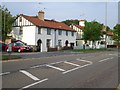

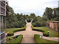
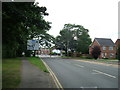
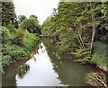
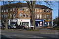
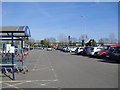
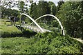
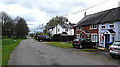
100 photos from this area
Area Information
Key information about the KT11 2AA including its size, population, and administrative classification.
- Area Type
- Postcode
- Area Size
- 1.4 hectares
- Population
- 1787
- Population Density
- 202 people/km²
House Prices in KT11 2AA
18
Properties
£1,060,821
Average Sold Price
£604,000
Lowest Price
£1,480,000
Highest Price
Showing 18 properties
| Address | Type | Beds | Baths | Last Sale Price | Last Sale Date | |
|---|---|---|---|---|---|---|
| Wyatt House, Cedar Road, Cobham, KT11 2AA | house | - | - | £1,480,000 | May 2023 | |
| Moffat, Cedar Road, Cobham, KT11 2AA | Detached | 4 | 3 | £1,100,000 | Dec 2021 | |
| Sandacre, Cedar Road, Cobham, KT11 2AA | house | - | - | £875,000 | Oct 2019 | |
| The Cottage, 3 Cedar Road, Cobham, KT11 2AA | house | - | - | £604,000 | Jul 2018 | |
| Stoke Gabriel, Cedar Road, Cobham, KT11 2AA | house | - | - | £1,205,250 | May 2017 | |
| The Rosary, Cedar Road, Cobham, KT11 2AA | house | - | - | £1,261,500 | Jun 2015 | |
| Aspen House, Cedar Road, Cobham, KT11 2AA | house | - | - | £900,000 | Jan 2012 | |
| Limes, Cedar Road, Cobham, KT11 2AA | Semi-detached | 5 | 4 | - | - | |
| Leighcroft, Cedar Road, Cobham, KT11 2AA | Semi-detached | 5 | 4 | - | - | |
| 2 Cedar Road, Cobham, KT11 2AA | Detached | 4 | 3 | - | - |
Page 1 of 2
Energy Efficiency in KT11 2AA
Amenities
Schools
| Rank | School | Type | Entry gender | Ages |
|---|
Explore more schools in this area
Go to Schools tabDemographics
Household Size
One person
most common
Accommodation Type
Houses
most common
Tenure
68
majority
Ethnic Group
White
most common
Religion
N/A
most common
Household Composition
N/A
most common
Age
47
median
Adults (30-64 years)
most common
Household Deprivation
N/A
with no deprivation
NS-SEC
47
in Lower managerial occupations
Explore more demographic insights in this area
Go to Demographics tabPlanning
Planning Constraints
- Flood RiskPremium
- Ramsar Wetland SitesPremium
- Area of Outstanding Natural BeautyPremium
- Protected Nature ReservePremium
- Protected WoodlandPremium