Area Overview for KT11 1PQ
Photos of KT11 1PQ


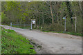
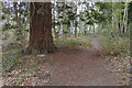
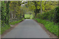
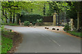
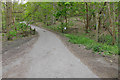
41 photos from this area
Area Information
Key information about the KT11 1PQ including its size, population, and administrative classification.
- Area Type
- Postcode
- Area Size
- 30.3 hectares
- Population
- 1787
- Population Density
- 202 people/km²
House Prices in KT11 1PQ
11
Properties
£1,001,667
Average Sold Price
£745,000
Lowest Price
£1,275,000
Highest Price
Showing 11 properties
| Address | Type | Beds | Baths | Last Sale Price | Last Sale Date | |
|---|---|---|---|---|---|---|
| Ty Bryn, Pointers Road, Cobham, KT11 1PQ | Detached | 4 | 2 | £1,070,000 | Jun 2023 | |
| Herons View, Pointers Road, Cobham, KT11 1PQ | Land | 6 | 3 | £1,275,000 | Dec 2019 | |
| Old Poynters, Pointers Road, Cobham, KT11 1PQ | Semi-detached | 4 | 2 | £1,235,000 | Sep 2019 | |
| Poynters Cottage, Pointers Road, Cobham, KT11 1PQ | house | - | - | £825,000 | Apr 2018 | |
| Woodlands, Pointers Road, Cobham, KT11 1PQ | house | - | - | £745,000 | Jan 2004 | |
| Poynters Lea, Pointers Road, Cobham, KT11 1PQ | Land | - | - | £860,000 | Jan 2003 | |
| Pointers South, Pointers Road, Cobham, KT11 1PQ | house | - | - | - | - | |
| Little Poynters, Pointers Road, Cobham, KT11 1PQ | Land | - | - | - | - | |
| Poynters, Pointers Road, Cobham, KT11 1PQ | Land | - | - | - | - | |
| The Barn, Pointers South, Pointers Road, Cobham, KT11 1PQ | Bungalow | 2 | 1 | - | - |
Page 1 of 2
Energy Efficiency in KT11 1PQ
Amenities
Schools
| Rank | School | Type | Entry gender | Ages |
|---|
Explore more schools in this area
Go to Schools tabDemographics
Household Size
One person
most common
Accommodation Type
Houses
most common
Tenure
68
majority
Ethnic Group
White
most common
Religion
N/A
most common
Household Composition
N/A
most common
Age
47
median
Adults (30-64 years)
most common
Household Deprivation
N/A
with no deprivation
NS-SEC
47
in Lower managerial occupations
Explore more demographic insights in this area
Go to Demographics tabPlanning
Planning Constraints
- Flood RiskPremium
- Ramsar Wetland SitesPremium
- Area of Outstanding Natural BeautyPremium
- Protected Nature ReservePremium
- Protected WoodlandPremium