Area Overview for KT11 1HS
Photos of KT11 1HS
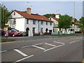

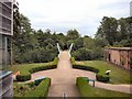
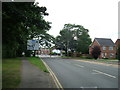
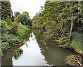
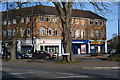
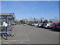
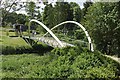
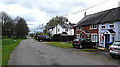
100 photos from this area
Area Information
Key information about the KT11 1HS including its size, population, and administrative classification.
- Area Type
- Postcode
- Area Size
- 1.4 hectares
- Population
- 1639
- Population Density
- 5980 people/km²
House Prices in KT11 1HS
46
Properties
£350,763
Average Sold Price
£167,000
Lowest Price
£530,000
Highest Price
Showing 46 properties
| Address | Type | Beds | Baths | Last Sale Price | Last Sale Date | |
|---|---|---|---|---|---|---|
| 178 Portsmouth Road, Cobham, KT11 1HS | Terraced | 3 | 1 | £405,000 | May 2024 | |
| 198 Portsmouth Road, Cobham, KT11 1HS | Terraced | 3 | 1 | £425,000 | Jan 2024 | |
| 174 Portsmouth Road, Cobham, KT11 1HS | Terraced | 3 | 1 | £327,000 | Jun 2023 | |
| 200 Portsmouth Road, Cobham, KT11 1HS | Terraced | 4 | 1 | £530,000 | Feb 2022 | |
| 194 Portsmouth Road, Cobham, KT11 1HS | house | 3 | 2 | £459,000 | Apr 2021 | |
| 170 Portsmouth Road, Cobham, KT11 1HS | Terraced | 3 | 1 | £330,000 | Jan 2021 | |
| 172 Portsmouth Road, Cobham, KT11 1HS | Terraced | 2 | - | £420,000 | Jun 2020 | |
| 184 Portsmouth Road, Cobham, KT11 1HS | Terraced | 2 | 2 | £425,000 | Jun 2020 | |
| 180 Portsmouth Road, Cobham, KT11 1HS | Semi-detached | 3 | 2 | £450,000 | Jun 2020 | |
| 182 Portsmouth Road, Cobham, KT11 1HS | Terraced | 3 | 1 | £450,000 | Jun 2020 |
Page 1 of 5
Energy Efficiency in KT11 1HS
Amenities
Schools
| Rank | School | Type | Entry gender | Ages |
|---|
Explore more schools in this area
Go to Schools tabDemographics
Household Size
One person
most common
Accommodation Type
Houses
most common
Tenure
53
majority
Ethnic Group
White
most common
Religion
N/A
most common
Household Composition
N/A
most common
Age
47
median
Adults (30-64 years)
most common
Household Deprivation
N/A
with no deprivation
NS-SEC
37
in Lower managerial occupations
Explore more demographic insights in this area
Go to Demographics tabPlanning
Planning Constraints
- Flood RiskPremium
- Ramsar Wetland SitesPremium
- Area of Outstanding Natural BeautyPremium
- Protected Nature ReservePremium
- Protected WoodlandPremium