Area Overview for KT11 1BG
Photos of KT11 1BG
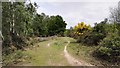
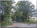
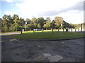
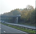

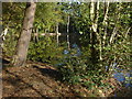
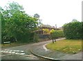
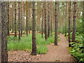
15 photos from this area
Area Information
Key information about the KT11 1BG including its size, population, and administrative classification.
- Area Type
- Postcode
- Area Size
- 6.0 hectares
- Population
- 1583
- Population Density
- 398 people/km²
House Prices in KT11 1BG
13
Properties
£1,044,333
Average Sold Price
£483,000
Lowest Price
£1,695,000
Highest Price
Showing 13 properties
| Address | Type | Beds | Baths | Last Sale Price | Last Sale Date | |
|---|---|---|---|---|---|---|
| White Lodge, Portsmouth Road, Cobham, KT11 1BG | Bungalow | 3 | 2 | £955,000 | Jun 2021 | |
| Selworthy, Portsmouth Road, Cobham, KT11 1BG | Detached | 7 | - | £1,695,000 | Mar 2011 | |
| Fairmile Corner Cottage, Portsmouth Road, Cobham, KT11 1BG | house | 4 | - | £483,000 | Dec 1999 | |
| Melbury, Fairmile Lea, Portsmouth Road, Cobham, KT11 1BG | Detached | 8 | 6 | - | - | |
| Fairmile Lea, Portsmouth Road, Cobham, KT11 1BG | house | 3 | - | - | - | |
| Little Wing, Fairmile Lea, Portsmouth Road, Cobham, KT11 1BG | house | 5 | - | - | - | |
| Mimosa Cottage, Portsmouth Road, Cobham, KT11 1BG | house | 4 | - | - | - | |
| Former Fairmile House, Portsmouth Road, Cobham, KT11 1BG | Detached | - | - | - | - | |
| Annexe, St Hilary, Portsmouth Road, Cobham, KT11 1BG | house | - | - | - | - | |
| Huntington House, Fairmile Lea, Portsmouth Road, Cobham, KT11 1BG | Detached | 6 | 4 | - | - |
Page 1 of 2
Energy Efficiency in KT11 1BG
Amenities
Schools
| Rank | School | Type | Entry gender | Ages |
|---|
Explore more schools in this area
Go to Schools tabDemographics
Household Size
Family (3-5 people)
most common
Accommodation Type
Houses
most common
Tenure
82
majority
Ethnic Group
White
most common
Religion
N/A
most common
Household Composition
N/A
most common
Age
47
median
Adults (30-64 years)
most common
Household Deprivation
N/A
with no deprivation
NS-SEC
48
in Lower managerial occupations
Explore more demographic insights in this area
Go to Demographics tabPlanning
Planning Constraints
- Flood RiskPremium
- Ramsar Wetland SitesPremium
- Area of Outstanding Natural BeautyPremium
- Protected Nature ReservePremium
- Protected WoodlandPremium