Area Overview for KT10 9EG
Photos of KT10 9EG
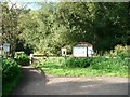
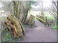
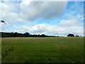
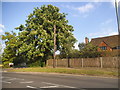
27 photos from this area
Area Information
Key information about the KT10 9EG including its size, population, and administrative classification.
- Area Type
- Postcode
- Area Size
- 5.3 hectares
- Population
- 1825
- Population Density
- 1680 people/km²
House Prices in KT10 9EG
31
Properties
£1,326,000
Average Sold Price
£227,900
Lowest Price
£2,105,000
Highest Price
Showing 31 properties
| Address | Type | Beds | Baths | Last Sale Price | Last Sale Date | |
|---|---|---|---|---|---|---|
| 37 Arbrook Lane, Esher, KT10 9EG | Detached | 5 | 1 | £1,675,000 | Oct 2022 | |
| 27 Arbrook Lane, Esher, KT10 9EG | Retail | 6 | 3 | £2,025,000 | Aug 2022 | |
| 47A Arbrook Lane, Esher, KT10 9EG | house | - | - | £2,000,000 | Aug 2022 | |
| 23 Arbrook Lane, Esher, KT10 9EG | Detached | 5 | 1 | £1,432,500 | May 2022 | |
| 25 Arbrook Lane, Esher, KT10 9EG | house | - | - | £1,627,500 | Apr 2021 | |
| 19 Arbrook Lane, Esher, KT10 9EG | Detached | 5 | 3 | £1,650,000 | Aug 2019 | |
| 35 Arbrook Lane, Esher, KT10 9EG | house | - | - | £1,715,000 | Feb 2019 | |
| 31 Arbrook Lane, Esher, KT10 9EG | Detached | 4 | 2 | £2,105,000 | Sep 2018 | |
| 9 Arbrook Lane, Esher, KT10 9EG | Detached | 5 | 3 | £1,400,100 | Dec 2015 | |
| 53 Arbrook Lane, Esher, KT10 9EG | house | 5 | - | £1,400,000 | Sep 2012 |
Page 1 of 4
Energy Efficiency in KT10 9EG
Amenities
Schools
| Rank | School | Type | Entry gender | Ages |
|---|
Explore more schools in this area
Go to Schools tabDemographics
Household Size
Family (3-5 people)
most common
Accommodation Type
Houses
most common
Tenure
79
majority
Ethnic Group
White
most common
Religion
N/A
most common
Household Composition
N/A
most common
Age
47
median
Adults (30-64 years)
most common
Household Deprivation
N/A
with no deprivation
NS-SEC
59
in Lower managerial occupations
Explore more demographic insights in this area
Go to Demographics tabPlanning
Planning Constraints
- Flood RiskPremium
- Ramsar Wetland SitesPremium
- Area of Outstanding Natural BeautyPremium
- Protected Nature ReservePremium
- Protected WoodlandPremium