Area Overview for KT10 9BX
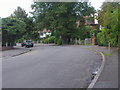
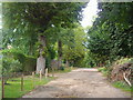
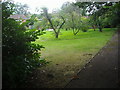
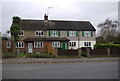
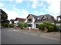
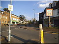
Photos of KT10 9BX


Area Information
KT10 9BX is a compact residential postcode in England, spanning just 2.0 hectares and home to 2,127 residents. This small area is characterised by its dense population density of 1,509 people per square kilometre, reflecting a tightly knit community. The area is predominantly occupied by homeowners, with 85% of properties owner-occupied, and the majority of homes are houses rather than flats. Daily life here is shaped by its proximity to key transport links and amenities. Residents benefit from nearby rail stations, including Claygate and Esher, which provide regular connections to London and surrounding towns. The area’s low crime risk score of 78 and absence of flood or environmental constraints make it an attractive option for families and professionals seeking stability. While the postcode is small, it offers access to essential services, from retail outlets like Co-op Claygate to ferry landings such as Ditton Island. The mix of practical infrastructure and a mature demographic—where the median age is 47 and most residents are between 30 and 64—suggests a community focused on established living rather than transient populations.
- Area Type
- Postcode
- Area Size
- 2.0 hectares
- Population
- 2127
- Population Density
- 1509 people/km²
KT10 9BX is a predominantly owner-occupied area, with 85% of properties held by residents rather than landlords. The housing stock is almost entirely composed of houses, which is unusual for a small postcode and may indicate a focus on family homes or larger properties. This suggests a market where buyers are likely to prioritise established, private residences over rental units. The compact size of the area—just 2.0 hectares—means property availability is limited, and the immediate surroundings may offer more options. For buyers, this implies a need to consider both the local character and the potential for long-term investment. The high home ownership rate also suggests a stable market with less turnover, which could be appealing to those seeking a secure place to live. However, the concentration of houses may limit diversity in property types, which could be a consideration for those preferring flats or newer developments.
House Prices in KT10 9BX
No properties found in this postcode.
Energy Efficiency in KT10 9BX
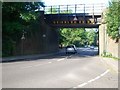
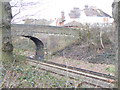
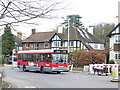
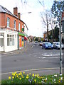
Living in KT10 9BX offers a blend of practical amenities and local character. Residents can access essential retail services at Co-op Claygate, Morrisons Daily, and Waitrose Esher, which cater to everyday shopping needs. For leisure, ferry landings such as Ditton Island and Hampton Court Pier provide opportunities for water-based activities or scenic trips. The proximity to rail stations like Esher and Claygate ensures easy access to broader networks, while the area’s compact size encourages walking or cycling to nearby points of interest. The presence of multiple retail and transport hubs within practical reach suggests a community that prioritises convenience without sacrificing local identity. Whether for groceries, commuting, or leisure, KT10 9BX offers a functional lifestyle with minimal need to travel far from home.
Amenities
Schools
| Rank | School | Type | Entry gender | Ages |
|---|
Explore more schools in this area
Go to Schools tabDemographics
The population of KT10 9BX is largely composed of adults aged 30 to 64, with a median age of 47. This indicates a mature, settled community with a strong presence of middle-aged residents. Home ownership is exceptionally high at 85%, suggesting a stable housing market where most properties are long-term investments rather than rentals. The area is predominantly occupied by White residents, with no specific data provided on other ethnic groups. The population density of 1,509 people per square kilometre implies a closely packed residential environment, which may influence local dynamics such as social cohesion and access to shared resources. The absence of detailed deprivation data means the quality of life here cannot be fully contextualised, but the low crime risk and lack of environmental constraints suggest a generally secure and functional living environment for its residents.
Household Size
Accommodation Type
Tenure
Ethnic Group
Religion
Household Composition
Age
Household Deprivation
NS-SEC
Explore more demographic insights in this area
Go to Demographics tabPlanning
Planning Constraints
- Flood RiskPremium
- Ramsar Wetland SitesPremium
- Area of Outstanding Natural BeautyPremium
- Protected Nature ReservePremium
- Protected WoodlandPremium