Area Overview for KT10 8QP
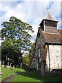
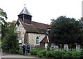
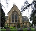
Photos of KT10 8QP


Area Information
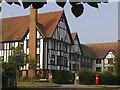
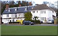
KT10 8QP is a small, tightly knit residential area in England, home to 1,736 people spread across a compact footprint. With a population density of 1,554 people per square kilometre, it reflects a community that values proximity to amenities and services. The area is defined by its mix of family homes and established neighbourhoods, attracting those seeking a balanced lifestyle. Residents benefit from being near key infrastructure, including multiple railway stations and retail hubs, while the surrounding landscape remains relatively low-key. The median age of 47 suggests a mature demographic, with many residents in their prime working years. Daily life here is characterised by a quiet, stable environment, where local shops, schools, and transport links provide convenience without the bustle of larger urban centres. For buyers, KT10 8QP offers a snapshot of suburban living, blending practicality with a sense of community.
- Area Type
- Postcode
- Area Size
- Not available
- Population
- 1736
- Population Density
- 1554 people/km²
KT10 8QP is primarily an owner-occupied area, with 77% of homes owned by residents rather than rented. The accommodation type is predominantly houses, which suggests a focus on family homes and semi-detached properties. This composition indicates a market where properties are likely to be held long-term, with limited turnover. For buyers, this means a small, stable housing stock that may require looking beyond immediate surroundings for alternative options. The high home ownership rate also implies that the area is less influenced by rental demand, which could affect property prices and availability. Given the postcode’s small size, prospective buyers may need to consider nearby areas for a broader selection of properties, though KT10 8QP itself offers a cohesive, residential character.
House Prices in KT10 8QP
No properties found in this postcode.
Energy Efficiency in KT10 8QP
Living in KT10 8QP offers access to a range of amenities within practical reach. The retail sector includes major chains like Waitrose Esher, Tesco Esher, and Morrisons Daily, ensuring convenience for everyday shopping. Nearby rail stations and ferry landings provide easy access to broader networks, whether for commuting or leisure. While the area lacks large parks or cultural hubs, the proximity to Esher and Claygate stations opens up opportunities for weekend outings. The mix of retail, transport, and local services creates a functional lifestyle, where residents can meet daily needs without venturing far. This balance of practicality and accessibility is a key draw for those prioritising convenience in their living arrangements.
Amenities
Schools
KT10 8QP is served by a range of schools, including Esher CofE Aided Primary School, a state-funded primary institution, and Bloo House, an independent school catering to younger children. Esher Church School, an academy with a ‘good’ Ofsted rating, provides additional options for secondary education. This mix of school types offers families flexibility, whether they prefer state education or the structure of independent schooling. The presence of a well-rated academy suggests a commitment to educational standards in the area. For parents, the variety of school choices reduces the pressure of relocation for schooling, making KT10 8QP an attractive option for families seeking both affordability and quality education.
| Rank | School | Type | Entry gender | Ages |
|---|---|---|---|---|
| 1 | Esher CofE Aided Primary School | primary | N/A | N/A |
| 2 | Bloo House | independent | N/A | N/A |
| 3 | Esher Church School | academy | N/A | N/A |
Explore more schools in this area
Go to Schools tabDemographics
The population of KT10 8QP skews towards adults aged 30–64, with a median age of 47. This suggests a community of established professionals and families, many of whom are homeowners—77% of households own their homes. The area is predominantly composed of houses, reflecting a preference for single-family living over flats. The predominant ethnic group is White, though the data does not specify further diversity metrics. The high home ownership rate and mature age profile indicate a stable, long-term resident base. With no specific deprivation data provided, the focus remains on the area’s practical appeal: a compact, well-serviced environment where most residents are likely to have built careers and raised families.
Household Size
Accommodation Type
Tenure
Ethnic Group
Religion
Household Composition
Age
Household Deprivation
NS-SEC
Explore more demographic insights in this area
Go to Demographics tabPlanning
Planning Constraints
- Flood RiskPremium
- Ramsar Wetland SitesPremium
- Area of Outstanding Natural BeautyPremium
- Protected Nature ReservePremium
- Protected WoodlandPremium
- Crime RiskPremium