Area Overview for KT10 8HU
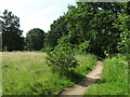
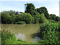
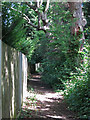
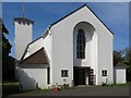
Photos of KT10 8HU


Area Information
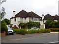
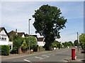
KT10 8HU is a small residential postcode in England, home to 2162 people spread across a compact cluster of properties. The area’s character is defined by its proximity to key transport links and a mix of local amenities that cater to daily needs. With a median age of 47, the community is predominantly composed of adults aged 30–64, suggesting a stable, family-oriented population. Home ownership is high at 87%, with most properties being houses rather than flats, indicating a preference for traditional, spacious living. The area’s low crime risk—scoring 90 out of 100—adds to its appeal as a safe, secure place to live. Residents benefit from excellent broadband connectivity (100/100 score) and a range of nearby schools, rail stations, and retail outlets. While the postcode is small, it offers a blend of practicality and accessibility, making it suitable for those seeking a balanced lifestyle without the pressures of larger urban centres.
- Area Type
- Postcode
- Area Size
- Not available
- Population
- 2162
- Population Density
- 2777 people/km²
KT10 8HU is primarily an owner-occupied area, with 87% of properties owned by residents rather than rented. The accommodation type is predominantly houses, which aligns with the area’s focus on traditional, family-friendly living. This suggests a market where buyers are likely seeking long-term stability rather than short-term investment. The high home ownership rate and prevalence of houses indicate limited rental availability, making the area more attractive to those prioritising property ownership. For buyers, this means a competitive market with fewer turnover opportunities but potentially stronger equity growth. The small postcode size means properties are closely clustered, so buyers should consider nearby areas for broader options. The emphasis on houses also implies a need for larger gardens or outdoor space, which may appeal to families.
House Prices in KT10 8HU
No properties found in this postcode.
Energy Efficiency in KT10 8HU
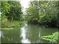
Residents of KT10 8HU enjoy a range of local amenities within practical reach. Retail options include Co-op Thames, Budgens Manor, and Budgens High, offering everyday shopping needs. The area’s ferry services, such as Ditton Island Ferry Landing and Moulsey, provide access to water-based leisure activities. Rail stations like Esher and Thames Ditton connect to broader transport networks, while nearby metro stations add to mobility. The presence of multiple retail and transport hubs suggests a convenient, self-contained lifestyle. Though the area is small, its amenities are sufficient for daily living, reducing the need for long commutes. The mix of retail, transport, and leisure options supports a practical, community-focused way of life.
Amenities
Schools
Residents of KT10 8HU have access to two notable schools: Emberhurst School, an independent institution, and The Drive First School, a primary school. The presence of both independent and state-run education options provides families with flexibility in choosing schooling for their children. The Drive First School caters to younger students, while Emberhurst offers a broader educational environment, possibly with specialist facilities or curricula. This mix ensures that families can select a school that aligns with their priorities, whether they seek a traditional state education or the resources of an independent institution. The proximity of these schools to the area underscores its appeal for families prioritising quality education.
| Rank | School | Type | Entry gender | Ages |
|---|
Explore more schools in this area
Go to Schools tabDemographics
The population of KT10 8HU is 2162, with a median age of 47, reflecting a mature demographic skewed toward adults aged 30–64. This age group constitutes the most common cohort, suggesting a community focused on stability and long-term residency. Home ownership is exceptionally high at 87%, with the majority of properties being houses rather than flats, indicating a preference for family-friendly, spacious housing. The predominant ethnic group is White, though specific data on diversity or deprivation is not provided. The age profile and home ownership rate suggest a community with established households, likely prioritising security and proximity to amenities. The absence of significant deprivation data means the area’s quality of life can be inferred from its safety, connectivity, and access to services.
Household Size
Accommodation Type
Tenure
Ethnic Group
Religion
Household Composition
Age
Household Deprivation
NS-SEC
Explore more demographic insights in this area
Go to Demographics tabPlanning
Planning Constraints
- Flood RiskPremium
- Ramsar Wetland SitesPremium
- Area of Outstanding Natural BeautyPremium
- Protected Nature ReservePremium
- Protected WoodlandPremium