Area Overview for KT10 8HS
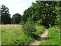
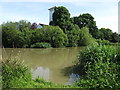
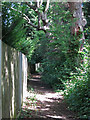
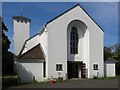
Photos of KT10 8HS


Area Information
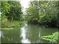
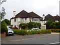
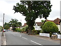
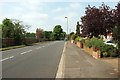
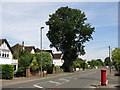
KT10 8HS is a small residential postcode in England, home to 2,162 residents. It is a compact cluster of homes, likely centred around a quiet, established neighbourhood with a mix of housing types. The area’s population suggests a tight-knit community, with daily life shaped by proximity to local amenities and transport links. Residents benefit from being within practical reach of schools, retail, and rail services, making it a convenient base for families and commuters. The postcode’s small size means it is likely surrounded by similar residential areas, creating a cohesive local environment. With no major industrial or commercial zones nearby, KT10 8HS appears to prioritise residential comfort. Its low crime risk and absence of environmental constraints like protected woodlands or wetlands further support a stable, low-stress living environment. For those seeking a balanced blend of accessibility and tranquillity, this area offers a snapshot of suburban England, where home ownership is high and community ties are strong.
- Area Type
- Postcode
- Area Size
- Not available
- Population
- 2162
- Population Density
- 2777 people/km²
KT10 8HS is a predominantly owner-occupied area, with 87% of properties owned by residents rather than rented. The housing stock is almost entirely composed of houses, which is uncommon in areas with higher flat or apartment density. This suggests a market skewed towards family homes and long-term investment, rather than short-term rental or student accommodation. Given the small size of the postcode, the property market is likely limited in scope, with buyers needing to consider nearby areas for more options. The high home ownership rate indicates a stable market, where properties are less likely to be vacant or available for sale. For buyers, this means a focus on established homes with potential for long-term value, though the limited inventory may require flexibility in location.
House Prices in KT10 8HS
No properties found in this postcode.
Energy Efficiency in KT10 8HS
Residents of KT10 8HS have access to a range of amenities within walking or short driving distance. Local retail options include Co-op Thames, Budgens Manor, and Budgens High, providing essentials and convenience for daily shopping. The area’s proximity to ferry services like Ditton Island Ferry Landing and Hampton Court Pier adds a unique dimension to leisure activities, offering opportunities for boating or waterfront relaxation. Rail stations such as Esher and Thames Ditton provide easy access to broader networks, while nearby metro stations like Hounslow Central connect to London’s transport system. These amenities collectively support a lifestyle that balances local convenience with regional accessibility. The presence of multiple retail and transport hubs suggests a practical, well-served community, where residents can meet daily needs without long journeys.
Amenities
Schools
Residents of KT10 8HS have access to two notable schools: Emberhurst School, an independent institution, and The Drive First School, a primary school. Emberhurst’s independent status may appeal to families seeking alternative education models, while The Drive First School provides early years and primary education for younger children. The presence of both school types suggests a range of educational options, catering to different preferences and needs. For families prioritising a single school, the proximity of these institutions reduces commuting time and enhances convenience. However, the absence of secondary schools within the postcode means residents may need to consider nearby areas for comprehensive schooling. The mix of school types reflects the area’s balance between traditional and independent education, a factor that could influence family decisions about relocation.
| Rank | School | Type | Entry gender | Ages |
|---|
Explore more schools in this area
Go to Schools tabDemographics
The population of KT10 8HS is predominantly adults aged 30–64, with a median age of 47. This suggests a mature, established community with a focus on long-term residency. Home ownership is exceptionally high at 87%, indicating a strong preference for property as an asset. The area is composed almost entirely of houses, rather than flats or apartments, which aligns with the demographic profile of older, family-oriented residents. The predominant ethnic group is White, reflecting a homogenous community. With no data on deprivation levels, it is reasonable to infer that the area’s stability and high home ownership contribute to a relatively high quality of life. The absence of younger age groups or rental properties suggests a community with limited turnover, where residents are likely to remain in the area for extended periods.
Household Size
Accommodation Type
Tenure
Ethnic Group
Religion
Household Composition
Age
Household Deprivation
NS-SEC
Explore more demographic insights in this area
Go to Demographics tabPlanning
Planning Constraints
- Flood RiskPremium
- Ramsar Wetland SitesPremium
- Area of Outstanding Natural BeautyPremium
- Protected Nature ReservePremium
- Protected WoodlandPremium