Area Overview for KT10 8EF
Photos of KT10 8EF
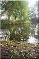
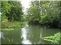
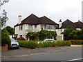
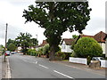
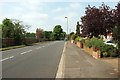
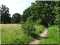
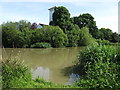
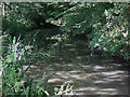
39 photos from this area
Area Information
Key information about the KT10 8EF including its size, population, and administrative classification.
- Area Type
- Postcode
- Area Size
- 9240 m²
- Population
- 2162
- Population Density
- 2777 people/km²
House Prices in KT10 8EF
9
Properties
£1,127,143
Average Sold Price
£725,000
Lowest Price
£1,500,000
Highest Price
Showing 9 properties
| Address | Type | Beds | Baths | Last Sale Price | Last Sale Date | |
|---|---|---|---|---|---|---|
| 57 Ember Lane, Esher, KT10 8EF | Detached | 4 | 3 | £1,125,000 | Apr 2024 | |
| 55 Ember Lane, Esher, KT10 8EF | Detached | 6 | 3 | £1,500,000 | May 2021 | |
| 59 Ember Lane, Esher, KT10 8EF | Detached | 5 | 1 | £1,210,000 | Nov 2020 | |
| 65 Ember Lane, Esher, KT10 8EF | Detached | 3 | 3 | £1,230,000 | Oct 2017 | |
| 49 Ember Lane, Esher, KT10 8EF | Detached | 4 | - | £999,999 | Mar 2013 | |
| 61 Ember Lane, Esher, KT10 8EF | Detached | 6 | - | £1,100,000 | Mar 2013 | |
| 63 Ember Lane, Esher, KT10 8EF | house | - | - | £725,000 | Jul 2007 | |
| 53 Ember Lane, Esher, KT10 8EF | Detached | - | - | - | - | |
| 51 Ember Lane, Esher, KT10 8EF | Detached | - | - | - | - |
Energy Efficiency in KT10 8EF
Amenities
Schools
| Rank | School | Type | Entry gender | Ages |
|---|
Explore more schools in this area
Go to Schools tabDemographics
Household Size
Family (3-5 people)
most common
Accommodation Type
Houses
most common
Tenure
87
majority
Ethnic Group
White
most common
Religion
N/A
most common
Household Composition
N/A
most common
Age
47
median
Adults (30-64 years)
most common
Household Deprivation
N/A
with no deprivation
NS-SEC
63
in Lower managerial occupations
Explore more demographic insights in this area
Go to Demographics tabPlanning
Planning Constraints
- Flood RiskPremium
- Ramsar Wetland SitesPremium
- Area of Outstanding Natural BeautyPremium
- Protected Nature ReservePremium
- Protected WoodlandPremium