Area Overview for KT10 0RW
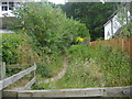
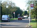
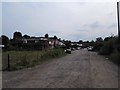
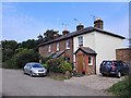
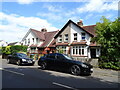
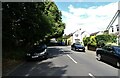
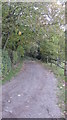
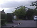
Photos of KT10 0RW

Area Information
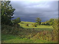
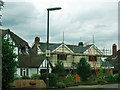
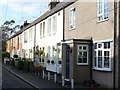
KT10 0RW is a compact residential postcode in England, home to 2127 people spread across a densely populated area of 1.41 km². This small cluster of homes reflects a tight-knit community, with a population density of 1509 people per square kilometre. The area is characterised by its focus on house ownership, with 85% of residents living in their own homes. Most residents fall within the 30-64 age range, suggesting a stable demographic of working-age adults and families. Daily life here is shaped by proximity to essential services, including five rail stations such as Claygate and Esher, which provide easy access to nearby towns. The area’s low crime risk and absence of environmental constraints make it an attractive option for those seeking a balance between convenience and tranquillity. Its compact size means amenities are within practical reach, while the predominance of houses over flats or apartments creates a distinct residential character. For buyers, KT10 0RW offers a blend of accessibility and community cohesion, though its small size means the property market is limited to a specific range of homes.
- Area Type
- Postcode
- Area Size
- Not available
- Population
- 2127
- Population Density
- 1509 people/km²
The property market in KT10 0RW is dominated by owner-occupied homes, with 85% of residents living in their own properties. This high rate of home ownership suggests a mature market with limited turnover, as few properties are available for rent. The area is composed primarily of houses rather than flats or apartments, which is typical of smaller, residential postcode clusters. This housing stock appeals to families and individuals seeking long-term stability, though the small size of the area means the market is tightly focused on a limited number of properties. Buyers should expect a competitive environment, as the number of available homes is constrained by the postcode’s compact size. The absence of rental properties indicates that most homes are held by long-term residents, which may affect the speed of transactions. For those considering KT10 0RW, the emphasis on houses over other accommodation types means buyers should prioritise properties that meet their specific needs for space and layout.
House Prices in KT10 0RW
No properties found in this postcode.
Energy Efficiency in KT10 0RW
Living in KT10 0RW provides access to a range of amenities within close proximity. Retail options include Co-op Claygate, Waitrose Little Waitrose, and Morrisons Daily, offering a mix of grocery and convenience shopping. The presence of five rail stations, such as Esher and Hinchley Wood, ensures easy travel to nearby towns and cities. Ferry access at locations like Hampton Court Pier and Kingston Town End Pier adds to the area’s connectivity, particularly for those preferring water-based travel. While the area lacks large-scale leisure facilities, its proximity to rail and ferry services means residents can quickly reach cultural or recreational hubs. The compact size of KT10 0RW means daily errands and social activities are within walking or short driving distance, contributing to a convenient, low-stress lifestyle. The combination of retail, transport, and nearby green spaces creates a balanced environment for both practical needs and leisure.
Amenities
Schools
| Rank | School | Type | Entry gender | Ages |
|---|
Explore more schools in this area
Go to Schools tabDemographics
The population of KT10 0RW is predominantly composed of adults aged 30-64, with a median age of 47. This suggests a mature, established community with a strong presence of working-age individuals and families. Home ownership is high, with 85% of residents living in their own homes, indicating a stable and long-term demographic. The area is largely composed of houses, which aligns with the demographic profile of older, settled households. The predominant ethnic group is White, reflecting a homogenous community. While no specific data on deprivation is provided, the high home ownership rate and low crime risk suggest a relatively high quality of life. The absence of protected natural areas or planning constraints means residents face fewer restrictions on property use or development. This combination of factors—stable demographics, strong ownership, and limited environmental constraints—creates a neighbourhood that prioritises comfort and continuity for its residents.
Household Size
Accommodation Type
Tenure
Ethnic Group
Religion
Household Composition
Age
Household Deprivation
NS-SEC
Explore more demographic insights in this area
Go to Demographics tabPlanning
Planning Constraints
- Flood RiskPremium
- Ramsar Wetland SitesPremium
- Area of Outstanding Natural BeautyPremium
- Protected Nature ReservePremium
- Protected WoodlandPremium