Area Overview for KT10 0ND
Photos of KT10 0ND
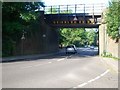

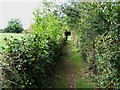
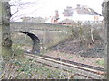
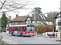
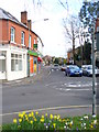
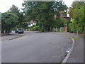
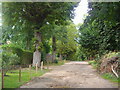
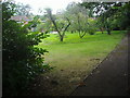
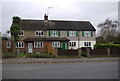
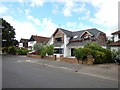
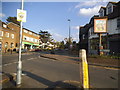
86 photos from this area
Area Information
Key information about the KT10 0ND including its size, population, and administrative classification.
- Area Type
- Postcode
- Area Size
- 3.2 hectares
- Population
- 1634
- Population Density
- 2655 people/km²
House Prices in KT10 0ND
35
Properties
£776,192
Average Sold Price
£307,000
Lowest Price
£1,470,000
Highest Price
Showing 35 properties
| Address | Type | Beds | Baths | Last Sale Price | Last Sale Date | |
|---|---|---|---|---|---|---|
| 36 Foley Road, Claygate, Esher, KT10 0ND | house | - | - | £1,470,000 | Apr 2025 | |
| 10 Foley Road, Claygate, Esher, KT10 0ND | house | 4 | 2 | £1,075,000 | Mar 2024 | |
| 44 Foley Road, Claygate, Esher, KT10 0ND | Semi-detached | 3 | 2 | £999,950 | Dec 2023 | |
| 54 Foley Road, Claygate, Esher, KT10 0ND | Semi-detached | 5 | 3 | £1,273,500 | Sep 2023 | |
| 12 Foley Road, Claygate, Esher, KT10 0ND | house | - | - | £995,000 | Sep 2021 | |
| 8 Foley Road, Claygate, Esher, KT10 0ND | house | - | - | £952,000 | Jan 2020 | |
| 48 Foley Road, Claygate, Esher, KT10 0ND | Semi-detached | 4 | 1 | £995,000 | Sep 2019 | |
| 38 Foley Road, Claygate, Esher, KT10 0ND | Semi-detached | 4 | 2 | £615,000 | Jul 2011 | |
| 14 Foley Road, Claygate, Esher, KT10 0ND | house | - | - | £685,250 | Feb 2011 | |
| 16 Foley Road, Claygate, Esher, KT10 0ND | Terraced | - | - | £620,000 | Sep 2008 |
Page 1 of 4
Energy Efficiency in KT10 0ND
Amenities
Schools
| Rank | School | Type | Entry gender | Ages |
|---|
Explore more schools in this area
Go to Schools tabDemographics
Household Size
Family (3-5 people)
most common
Accommodation Type
Houses
most common
Tenure
67
majority
Ethnic Group
White
most common
Religion
N/A
most common
Household Composition
N/A
most common
Age
47
median
Adults (30-64 years)
most common
Household Deprivation
N/A
with no deprivation
NS-SEC
49
in Lower managerial occupations
Explore more demographic insights in this area
Go to Demographics tabPlanning
Planning Constraints
- Flood RiskPremium
- Ramsar Wetland SitesPremium
- Area of Outstanding Natural BeautyPremium
- Protected Nature ReservePremium
- Protected WoodlandPremium