Area Overview for Kemsley Ward
Photos of Kemsley Ward


Area Information
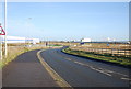
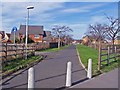
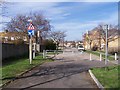
Kemsley Ward is a compact district within the Borough of Rochester and Dartford, covering just 4.1 square kilometres. This small footprint supports a population of 1,513 residents, resulting in a community density of 369 people per square kilometre. Living in Kemsley Ward means being part of a tightly knit environment where neighbours are likely to know one another due to the limited land space. The area is situated in Kent, England, and serves as a distinct residential unit within the larger local authority structure. Daily life here is defined by this manageable scale, which offers a sense of scale that larger urban wards often lack. Prospective buyers should understand that Kemsley Ward is not a sprawling suburb but a concentrated slice of the borough. The sheer size of the area limits the variety of immediate local amenities, meaning many daily needs often extend beyond the ward boundaries. However, the small size also means that official statistics reflect the lived experience of the majority very directly. There is a clear, focused character to the ward that emerges from its specific population size and geographical limits. You can expect a neighbourhood where the compact nature of the land is the primary defining feature of your surroundings.
- Area Type
- District Borough Unitary Ward
- Area Size
- 4.1 km²
- Population
- 1513
- Population Density
- 369 people/km²
Demographics
The community profile of Kemsley Ward is heavily influenced by its demographic makeup, which shows a median age of 70 years. This figure indicates that half the population is over the age of seventy, painting a picture of an establishment area with older residents. The provided data categorises the most common age range simply as 'Total', yet the median age remains the clearest indicator of the district's lifecycle. With 69 per cent of households reporting home ownership, the area is predominantly owner-occupied rather than a high-rental zone. This high rate of ownership often suggests long-term settlement and stability within the local community. While specific breakdowns for household composition, predominant ethnic groups, and religious affiliations are recorded as totals in the dataset, the ownership statistic provides a concrete measure of the area's character. A ownership figure of this magnitude typically reduces the volatility associated with rent-heavy districts. The environment supports an elderly demographic, which implies that local services and transport provisions will cater to those with mobility considerations or retired lifestyles. You are buying into a area where the majority of households have stayed for the long term, as evidenced by the high ownership percentage. The data does not specify further income or deprivation details, but the age and ownership figures strongly define the social fabric of Kemsley Ward.
Household Size
Accommodation Type
Tenure
Ethnic Group
Religion
Household Composition
Age
Household Deprivation
NS-SEC
Explore more demographic insights in this area
Go to Demographics tabPlanning
Planning Constraints
- Flood RiskPremium
- Ramsar Wetland SitesPremium
- Area of Outstanding Natural BeautyPremium
- Protected Nature ReservePremium
- Protected WoodlandPremium
- Crime RiskPremium