Area Overview for Isle of Wight
Photos of Isle of Wight


Area Information
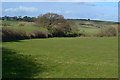
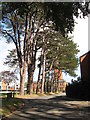
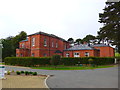
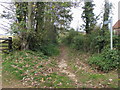
The Isle of Wight sits off the south coast of England, separated from the mainland by the Solent strait. This ceremonial county covers an area of 395.2 square kilometres and takes roughly 37 km east-west. The landscape feels compact yet diverse, containing 100 sq mi of farmland, 20 sq mi of developed areas, and 57 miles of coastline. You will find chalk downs in the west, oak woodlands on northern clays, and cliffbound coasts in the south. St Boniface Down marks the highest point at 241 m, while the Needles form three chalk stacks off the western tip. The whole island was designated a UNESCO Biosphere Reserve in 2019, cementing its natural importance. Newport acts as the administrative centre, but the largest settlement is Ryde, which faces the Solent directly. Residents often refer to the western part as the "Back of the Wight," a term that highlights the region's distinct rural character. The surrounding English Channel defines the island's isolation, creating a secluded environment often called "England in miniature." Living in Isle of Wight means navigating a mix of dramatic chalk ridges and soft cliffs, with the Eastern and Western Yar rivers cutting through the terrain. This unique geography shapes every aspect of daily life, from commuting to coastal views.
- Area Type
- Ceremonial Counties Region
- Area Size
- 395.2 km²
- Population
- Not available
- Population Density
- Not available
Demographics
Community demographics on the Isle of Wight reflect an older population profile. The median age stands at 70, indicating that most residents belong to an older generation. While the data groups ages under a single category, the high median confirms a shift away from a young workforce. Sixty-eight per cent of households own their homes, showing a strong tradition of home ownership across the island. The remaining households likely rent, though the specific breakdown provided focuses on this dominant ownership figure. Accommodation types are not detailed in the available figures, but the high ownership rate suggests a stable stock of long-term residences. The region lacks statistical data on predominant ethnic groups or religious affiliations, yet the demographic age profile paints a clear picture of who resides here. You can expect a quieter demographic rather than a young, transient community. This age structure influences local services, community groups, and the general pace of life. Living in Isle of Wight means engaging with an older population that values stability. The household composition data notes a total count, but the age median remains the defining characteristic of the area's social fabric.