Area Overview for Isle of Grain
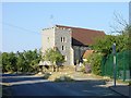
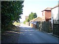
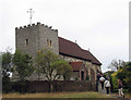
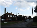
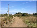
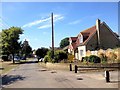
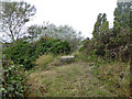
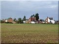
Photos of Isle of Grain


Area Information
Isle of Grain stands as a distinct civil parish covering 23.1 km², offering a settled environment on the edge of the Thames estuary. Living in this area means embracing a community defined by deep-rooted stability rather than transient urban energy. The landscape is characterised by its proximity to water, creating a backdrop for daily life that differs from typical suburban settings. While the specific population count is not detailed in current records, the extended demographic profile suggests a community settling down rather than expanding rapidly. You might find yourself in a neighbourhood where the pace of life is measured by tides and seasons as much as by employment schedules. The parish structure indicates a level of local governance focused on these specific geographic boundaries. Daily routines involve navigating an environment where the connection to the river shapes rather than hinders your lifestyle. Prospective residents looking for homes in Isle of Grain should expect a location where history and geography dictate the character of the streets. This setting provides a quiet alternative to the noise of larger conurbations, though you must weigh the natural advantages against specific environmental realities that define the land.
- Area Type
- Parish
- Area Size
- 23.1 km²
- Population
- Not available
- Population Density
- Not available
Demographics
The community in Isle of Grain presents a clear demographic profile with a median age of 70. This figure indicates that the majority of residents are seniors, creating a village atmosphere where age groups cluster together. When looking at the breakdown by most common age range, the data confirms that the 'Age: Total' category represents the broadest segment, reinforcing the idea that the population is heavily weighted toward older demographics. Home ownership stands at 75 per cent, a figure that signals a highly stable community where established residents own their properties rather than renting. This high rate of ownership suggests long-term settlement patterns and a lack of transient housing turnover. Accommodation types reflect this ownership stability, although specific breakdowns by property style are not segregated in the provided data. You will find that the local population is defined by its seniority and tenure status. Ethnic diversity and religious affiliations are noted in the data fields but are not specified with detailed percentages, focusing the community narrative on age and tenure instead. For anyone considering moving here, the demographic reality is a mature environment where neighbours are likely to be your age or older, fostering a specific type of social interaction.
Household Size
Accommodation Type
Tenure
Ethnic Group
Religion
Household Composition
Age
Household Deprivation
NS-SEC
Explore more demographic insights in this area
Go to Demographics tabPlanning
Planning Constraints
- Flood RiskPremium
- Ramsar Wetland SitesPremium
- Area of Outstanding Natural BeautyPremium
- Protected Nature ReservePremium
- Protected WoodlandPremium
- Crime RiskPremium