Area Overview for HP9 2PZ
Photos of HP9 2PZ
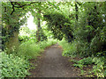
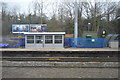
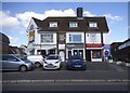
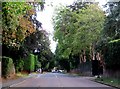
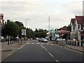
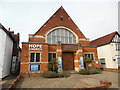
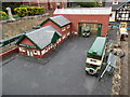
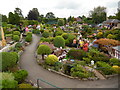
100 photos from this area
Area Information
Key information about the HP9 2PZ including its size, population, and administrative classification.
- Area Type
- Postcode
- Area Size
- 3.3 hectares
- Population
- 1819
- Population Density
- 346 people/km²
House Prices in HP9 2PZ
30
Properties
£1,330,700
Average Sold Price
£345,000
Lowest Price
£3,475,000
Highest Price
Showing 30 properties
| Address | Type | Beds | Baths | Last Sale Price | Last Sale Date | |
|---|---|---|---|---|---|---|
| Hamlet, 2B Ledborough Lane, Beaconsfield, HP9 2PZ | Terraced | 3 | 3 | £975,000 | Jul 2023 | |
| Site Of Former Pendeen, 4 Ledborough Lane, Beaconsfield, HP9 2PZ | Detached | 4 | 3 | £1,650,000 | Aug 2022 | |
| 17A Ledborough Lane, Beaconsfield, HP9 2PZ | house | - | - | £3,475,000 | Jul 2022 | |
| 21 Ledborough Lane, Beaconsfield, HP9 2PZ | Detached | 6 | 4 | £2,325,000 | Sep 2020 | |
| 19A Ledborough Lane, Beaconsfield, HP9 2PZ | house | - | - | £2,250,000 | Oct 2018 | |
| 2A Ledborough Lane, Beaconsfield, HP9 2PZ | Terraced | 3 | - | £690,000 | Apr 2014 | |
| 9 Ledborough Lane, Beaconsfield, HP9 2PZ | Semi-detached | - | - | £547,000 | Jul 2004 | |
| 18 Ledborough Lane, Beaconsfield, HP9 2PZ | Semi-detached | - | - | £510,000 | Apr 2004 | |
| 2 Ledborough Lane, Beaconsfield, HP9 2PZ | Flat | 2 | 2 | £540,000 | Dec 2002 | |
| 7 Ledborough Lane, Beaconsfield, HP9 2PZ | Semi-detached | - | - | £345,000 | Jul 1998 |
Page 1 of 3
Energy Efficiency in HP9 2PZ
Amenities
Schools
| Rank | School | Type | Entry gender | Ages |
|---|
Explore more schools in this area
Go to Schools tabDemographics
Household Size
Two person
most common
Accommodation Type
Houses
most common
Tenure
84
majority
Ethnic Group
White
most common
Religion
N/A
most common
Household Composition
N/A
most common
Age
47
median
Adults (30-64 years)
most common
Household Deprivation
N/A
with no deprivation
NS-SEC
59
in Lower managerial occupations
Explore more demographic insights in this area
Go to Demographics tabPlanning
Planning Constraints
- Flood RiskPremium
- Ramsar Wetland SitesPremium
- Area of Outstanding Natural BeautyPremium
- Protected Nature ReservePremium
- Protected WoodlandPremium