Area Overview for HP9 2LB
Photos of HP9 2LB
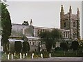
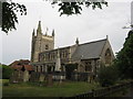
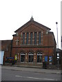
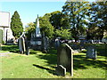
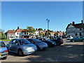
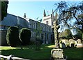
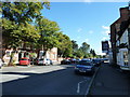
99 photos from this area
Area Information
Key information about the HP9 2LB including its size, population, and administrative classification.
- Area Type
- Postcode
- Area Size
- 4752 m²
- Population
- 1710
- Population Density
- 231 people/km²
House Prices in HP9 2LB
26
Properties
£546,124
Average Sold Price
£130,000
Lowest Price
£1,930,000
Highest Price
Showing 26 properties
| Address | Type | Beds | Baths | Last Sale Price | Last Sale Date | |
|---|---|---|---|---|---|---|
| 36 Lakes Lane, Beaconsfield, HP9 2LB | Terraced | 2 | 1 | £475,000 | Nov 2025 | |
| 16 Lakes Lane, Beaconsfield, HP9 2LB | Terraced | 3 | 2 | £830,000 | May 2025 | |
| 18 Lakes Lane, Beaconsfield, HP9 2LB | Terraced | 2 | 1 | £580,000 | Feb 2025 | |
| 54 Lakes Lane, Beaconsfield, HP9 2LB | Detached | 6 | 3 | £1,930,000 | Nov 2024 | |
| 30 Lakes Lane, Beaconsfield, HP9 2LB | Terraced | 2 | 2 | £795,000 | Jun 2024 | |
| 50 Lakes Lane, Beaconsfield, HP9 2LB | Terraced | 2 | 1 | £525,000 | Sep 2023 | |
| 10 Lakes Lane, Beaconsfield, HP9 2LB | Terraced | 2 | 1 | £525,000 | Oct 2022 | |
| 26 Lakes Lane, Beaconsfield, HP9 2LB | Terraced | 2 | 1 | £512,500 | Jul 2022 | |
| 38 Lakes Lane, Beaconsfield, HP9 2LB | Terraced | 2 | 1 | £391,725 | Jun 2021 | |
| 48 Lakes Lane, Beaconsfield, HP9 2LB | Terraced | 2 | - | £540,000 | Jun 2021 |
Page 1 of 3
Energy Efficiency in HP9 2LB
Amenities
Schools
| Rank | School | Type | Entry gender | Ages |
|---|
Explore more schools in this area
Go to Schools tabDemographics
Household Size
Family (3-5 people)
most common
Accommodation Type
Houses
most common
Tenure
47
majority
Ethnic Group
White
most common
Religion
N/A
most common
Household Composition
N/A
most common
Age
47
median
Adults (30-64 years)
most common
Household Deprivation
N/A
with no deprivation
NS-SEC
42
in Lower managerial occupations
Explore more demographic insights in this area
Go to Demographics tabPlanning
Planning Constraints
- Flood RiskPremium
- Ramsar Wetland SitesPremium
- Area of Outstanding Natural BeautyPremium
- Protected Nature ReservePremium
- Protected WoodlandPremium